
- elevation 1,240 m (4,068 ft) Basin area 33,670 km² | Length 470 km Basin area 33,670 km² | |
 | ||
Similar Fly River, Sepik River, Mount Wilhelm, Bismarck Range, Owen Stanley Range | ||
Fishing papua new guinea purari river fauna survey
The Purari is a river in that originates in the south central highlands of Papua New Guinea, flowing 470 kilometres (292 mi) though the Gulf Province to the Gulf of Papua. The Purari has a 33,670 km2 (13,000 sq mi) drainage basin and is the third largest river in Papua New Guinea.
Contents
Map of Purari River, Papua New Guinea
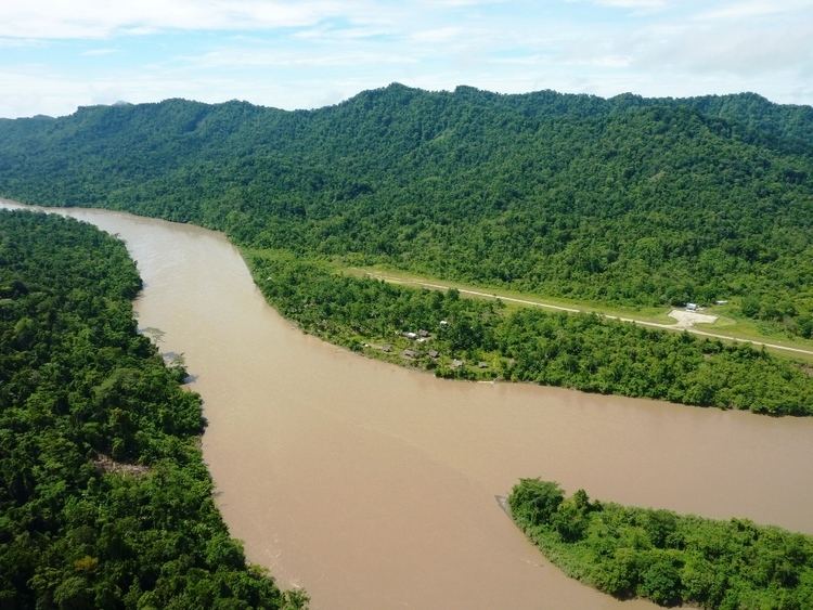
It is fed mainly by the Kaugel, Erave, Tua and Pio rivers, starting just south of Mount Karimui at the junction of the Tua and Pio rivers, where it flows through a quite spectacular gorge before flowing out into the lowlands and delta country closer to the coast. Along the river in various places there are small human populations, mostly subsistence villages. Dugout canoes are seen along the river from Wabo downstream, however population is sparse until you get closer to the coast where there are a few more villages.
The general area is heavy tropical jungle with high rainfall and abundant birdlife. The Purari is a heavy muddy brown from silts washed down from the mountains, and rises and falls constantly depending on local rainfall. It is also tidal a substantial distance from the coast.
The headwaters of the river were charted in 1930 by Michael Leahy and Michael Dwyer.
The governments of Papua New Guinea and Government of Queensland have signed a Memorandum of Cooperation with PNG Energy Developments Ltd (PNG EDL) and Origin Energy (Origin) to support the potential development of a renewable hydro electricity project based on the Purari.