
 | ||
Similar Basilica di Santa Maria di, Galleria Rizzi, Baia del Silenzio, Moneglia, Framura railway station | ||
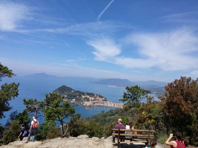
Punta Manara is the end of a promontory extended in the Gulf of Tigullio between the Ligurian town of Sestri Levante and Riva Trigoso in the province of Genoa, Italy, subject to environmental protection since 1977.
Contents
Map of punta Manara, 16039 Sestri Levante, Genoa, Italy
Destination for many tourists from all over the world, is one of the most popular tours for the visitors of the city. Located at the west of the Gulf of Tigullio, it offers glimpses of the coast and many plant and animal species that inhabit the Maquis shrubland.
The headland is approximately 190 hectares of which about 50 are entirely occupied by ilex trees, while the remaining spaces are divided between high maquis (arbutus, heather) and a small strip of cork oak, while the more extended plant population is the maritime pine that cover the maximum altitude of the promontory, called Monte Castello, at 265 metres above sea level. In this part of the promontory are still visible the ruins of an ancient fortress and a more recent building used by the Territorial Militia and by the Germans during the last conflict.
Located near the eastern far end of the Gulf, in the heart of a nature reserve, inside you can observe the remains, still well preserved, of the Saracen tower, that stands at about 140 metres high above sea level. Characterized by strategic importance, it has always been an excellent sighting point for the control of the Marine front. It is post on the same geographical line of Punta Chiappa and Punta Mesco, other important coastal landmarks.
The north mountainside collects the water conveyed by the Rio Ravino which crosses the main path to the headland. Although characterised by a very modest carrying capacity, it collects water from several smaller tributaries and is a useful water resource for fields planted with vegetables and olives in the below village called Ginestra. The annual rainfall in the area is about 1200 mm.
Punta Manara can only be reached through paths that climb the promontory above Sestri Levante. A path starts from the alleys of the old town and after a series of steps leading out of the village, begins a walk almost flat, which is surrounded by the typical Ligurian vegetation. Once in Punta Manara, you can choose to continue with the path and get off at Riva Trigoso.
On the promontory there is the so-called "Sentiero Natura" path (see map) which is a hiking path of rare naturalistic beauty in the landscapes of Liguria. In many parts of the trail there are illustrative signs describing the plant species that visitors can see during the tour.
The "Bivacco Manara" is a campsite located near the end of the promontory, at the meeting point of the main paths, and it is equipped for an overnight stay. The property is managed by the municipality of Sestri Levante.
Flora
Some of the plant species present on the headland are: strawberry tree, rock samphire, marine samphire, myrtus, cistus, erica arborea, mastic, broom. The tree species present are: black alder, holm oak, cork oak, maritime pine.