
Founded April 7, 1954 Subdivisions 4 populated centers Area 119.5 km² | Region Lima Capital Punta Hermosa Elevation 18 m (59 ft) | |
 | ||
Surf trip peru punta hermosa
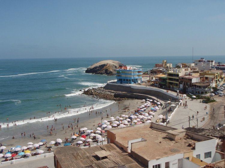
Punta Hermosa is one of 43 districts of the Lima Province in Peru. The capital of the district is the village of Punta Hermosa. The district's main attractions are its beaches.
Contents
- Surf trip peru punta hermosa
- Map of Punta Hermosa Peru
- Sofia mulanovich surf academy punta hermosa peru
- Geography
- Political division
- Beach resort
- References
Map of Punta Hermosa, Peru
Sofia mulanovich surf academy punta hermosa peru
Geography
Punta Hermosa borders the Pacific Ocean on the west, the Lurín District on the north, Huarochirí Province's district of Santo Domingo de los Olleros on the east and the Punta Negra district on the south.
Political division
The district is divided into 4 populated centers (Spanish: Centros Poblados):
Beach resort
Punta Hermosa is located 42 km south of downtown Lima, to which it is connected by the Pan-American Highway. The district's main attraction is its beaches, which are visited by thousands of people every summer. The area, which used to be a resort/vacation district where visitors stayed only temporarily, has recently seen an urban expansion and an increase in permanent year-round residents.