
Length 320 km | Basin area 4,511 km² | |
 | ||
- left Bobonawan River, Sawaga River, Manupali River, Muleta River, Maradugao River, Malitubog River, Maramag River - right Tigwa River, Kabacan River, Dampilasan River, Maapag River, Laligan River, Kalabugao River, Tinanan River, Kulaman River, Arakan River - location Brgy. Kalabugao, Impasugong, Bukidnon, Mount Dulang-dulang, Mount Mangabon, Mount Kalatungan, San Fernando, Bukidnon | ||
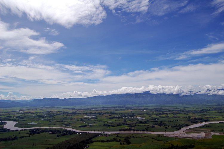
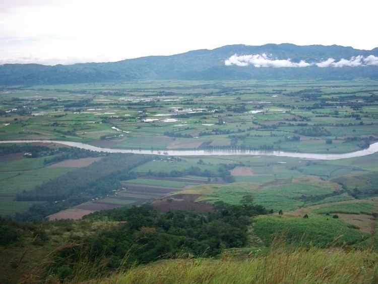
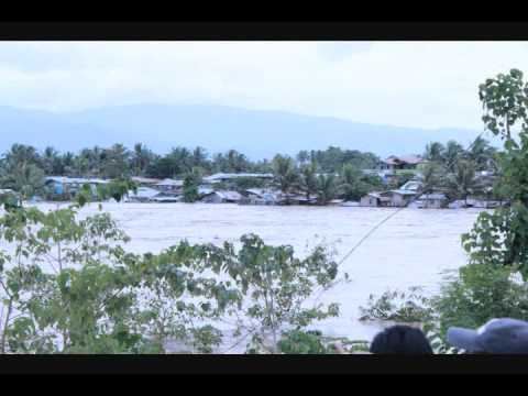
Bukidnon river overflow pulangi river
The Pulangi River (Cebuano pronunciation IPA [puˈlaŋi]), also spelled Pulangui, is the longest river in Bukidnon. It is one of the major tributaries of the Rio Grande de Mindanao, an extensive river system in Mindanao, Philippines. It has a length of 320 kilometers and traverses through majority of the cities and municipalities of Bukidnon from its source in Barangay Kalabugao, Impasugong, Bukidnon.
Contents
- Bukidnon river overflow pulangi river
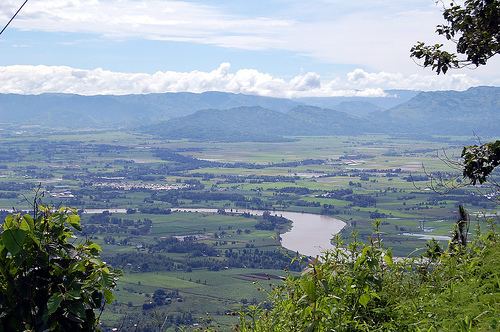
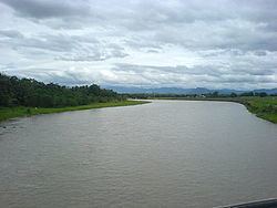
- Pulangi river valencia city dec 27 2011 background song by adam lambert time for miracles wmv
- Etymology
- Watershed and Hydroelectric Plant
- Sources
- Tributaries
- References
Pulangi river valencia city dec 27 2011 background song by adam lambert time for miracles wmv
Etymology
The name of the river could have come from the Manobo term “Empamulangi”, meaning "center of the island", referring to the location of the river within the island of Mindanao.
Watershed and Hydroelectric Plant
Pulangi has one reservoir type power plant, the Pulangi IV Hydroelectric Plant and watershed. The Pulangi IV Hydroelectric Plant has a capacity of 255 megawatts and provides for 25% of Mindanao's power needs. It is owned and operated by the National Power Corporation(NAPOCOR). The reservoir and dam is also the main water source for the province of Bukidnon, both for drinking water and for irrigation through the National Irrigation Administration (NIA).
The Pulangi IV Hydroelectric Plant watershed (also known as the Upper Pulangi Watershed) is the second largest watershed in the Philippines, covering an area of around 1.8 Million hectares. It has ten catchments and covers the cities and municipalities of Impasugong, Cabanglasan, San Fernando, Lantapan, Maramag, Quezon, Valencia City, and Malaybalay City.
The artificial lake created by the reservoir proper is called the Pulangi Lake or the Maramag Basin It has a surface area of about 1,985 hectares and a live storage of 67 Million cubic meters.
Pulangi is also the site of the proposed Pulangi V Hydroelectric Dam. The project is expected to generate 300 megawatts of renewable energy for Mindanao in southern Philippines. The dam is 3,300 hectares covering portions, mostly highly sloping lands along the riverbank in 22 barangays in Kitaotao, Kibawe, Dangcagan and Damulog in Bukidnon and Roxas town in North Cotabato, Including the Carmen Bridge Border Kabacan Carmen) North Cotabato . Of the total dam area, 40% is the present river itself and the inundated areas are stiff slopes along the river bank. An estimated of 1,060 households will be affected, all of whom will be relocated and compensated by the project.
Opposition to the project have claimed that the project would submerge the burial site of Apo Mamalu, a revered ancestor of the Manobo indigenous people in Mindanao. There, however, are conflicting claims to this.
The National Museum of the Philippines has commissioned a team of experts to look into this claim, but as of February 6, 2011, the anthropologist asked to study the claim in response to a petition to declare Sitio Mikasili, Barangay Tangkulan, Damulog as a National Heritage Site said that there is not enough evidence to declare it as such. Dr. Antonio Montalvan, an anthropologist who earlier supported the petition to declare the site as a heritage site wrote the National Museum saying that after deeper scrutiny of the claims, a declaration of a National Heritage site is not feasible. Montalvan said: "Such an important declaration cannot be made when the assumptions lack unanimity and more so in material evidence. This may only lead to an obfuscation of the ethno-cultural importance and beautiful traditions of the ancient Manobo peoples."
Sources
Barangay Kalabugao, Impasugong, Bukidnon,
Other Sources, Mount Dulang-dulang, Kitanglad Mountain Range, Mount Kalatungan, Mount Mangabon Misamis Oriental
Tributaries
The Manupali River, a major tributary of the Pulangi River, starts in the mountains of Lantapan, Bukidnon, picking up tributaries along the way from the Kalatungan and Kitanglad Mountain Ranges. It forms part of the natural boundary of Valencia City and Lantapan. It flows eastward towards Malaybalay City, eventually joining the Pulangi River in Valencia City.
The Muleta River is located in the southern part of the province and traverses several municipalities including Pangantucan, Don Carlos, Kitaotao, Dangcagan, Kibawe, Kadingilan, and Damulog. It serves as a significant tributary of the Pulangi River, flowing southward and eventually converging with the Pulangi River at the boundary between Bukidnon and Cotabato provinces.
The Bobonawan River, found in the municipality of Cabanglasan, is another tributary of the Pulangi River. It covers most of the parts of the municipality, flowing southward towards Pulangi River.
Other tributaries are the Tigwa River of San Fernando, Bukidnon, the Maradugao River. Kalabugao River of Impasugong, Bukidnon Sawaga River of Malaybalay City. Abuhan River and Balongkot River of Managok, Malaybalay City. Kabacan River in North Cotabato, Dampilasan River in Impasugong Bukidnon, Maapag River of Valencia Bukidnoon, Laligan River of Valencia Bukidnoon, Malitubog River In North Cotabato