
 | ||
Municipal district Pryazhinsky Municipal District Urban settlement Pryazhinskoye Urban Settlement | ||
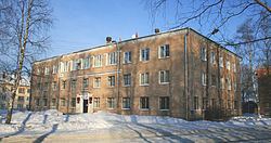
Pryazha (Russian: Пря́жа; Karelian: Priäžä; Finnish: Prääsä) is an urban locality (an urban-type settlement) and the administrative center of Pryazhinsky District of the Republic of Karelia, Russia, located 12 kilometers (7.5 mi) from the Shuya River and 49 kilometers (30 mi) west of Petrozavodsk, the capital of the republic. As of the 2010 Census, its population was 3,675.
Contents
- Map of Pryazha Republic of Karelia Russia 186120
- History
- Administrative and municipal status
- Tourism
- References
Map of Pryazha, Republic of Karelia, Russia, 186120
History
It was first mentioned in the 17th century as the village of Pryazha or Padlovo (Падлово). It was granted urban-type settlement status in 1962.
Administrative and municipal status
Within the framework of administrative divisions, Pryazha serves as the administrative center of Pryazhinsky District, of which it is a part. As a municipal division, Pryazha, together with three rural localities, is incorporated within Pryazhinsky Municipal District as Pryazhinskoye Urban Settlement.
Tourism
The Blue Highway, an international tourist route, starts in Mo i Rana, Norway, goes through Sweden and Finland, and then through Pryazha, before ending in Pudozh.