
Administrative district Pudozhsky District Local time Wednesday 11:28 PM | Administrative center of Pudozhsky District | |
 | ||
Municipal district Pudozhsky Municipal District Urban settlement Pudozhskoye Urban Settlement Weather -8°C, Wind NW at 10 km/h, 80% Humidity | ||
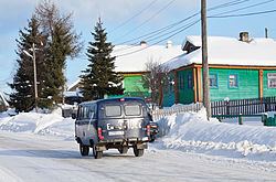
Pudozh (Russian: Пудож; Karelian: Puudoži; Veps: Pudož; Finnish: Puudosi or Puutoinen) is a town and the administrative center of Pudozhsky District of the Republic of Karelia, Russia, located on the Vodla River 115 kilometers (71 mi) east of Petrozavodsk, but 352 kilometers (219 mi) traveling by the road around Lake Onega. Population: 9,698 (2010 Census); 10,632 (2002 Census); 10,982 (1989 Census); 8,000 (1970).
Contents
Map of Pudozh, Republic of Karelia, Russia, 186150
An international tourist route Blue Highway ends in Pudozh. The route leads from Norway via Sweden and Finland to Republic of Karelia.
History
It was first mentioned in 1382 as a settlement of Pudoga, which would later be called Pudozhsky Pogost. It was granted town status in 1785.
Administrative and municipal status
Within the framework of administrative divisions, Pudozh serves as the administrative center of Pudozhsky District, to which it is directly subordinated. As a municipal division, the town of Pudozh, together with eleven rural localities, is incorporated within Pudozhsky Municipal District as Pudozhskoye Urban Settlement.