Harman Patil (Editor)

Prince Charles Mountains

Updated on
Edit
Like
Comment
Share on FacebookTweet on TwitterShare on LinkedInShare on Reddit
Country
  
Mountains
  
Shaw Massif

Prince Charles Mountains Prince Charles Mountains Australian Antarctic Division

Similar
  
Mount Kirkpatrick, Eastern Ghats, Dome A, Mount Terror, Mount Erebus

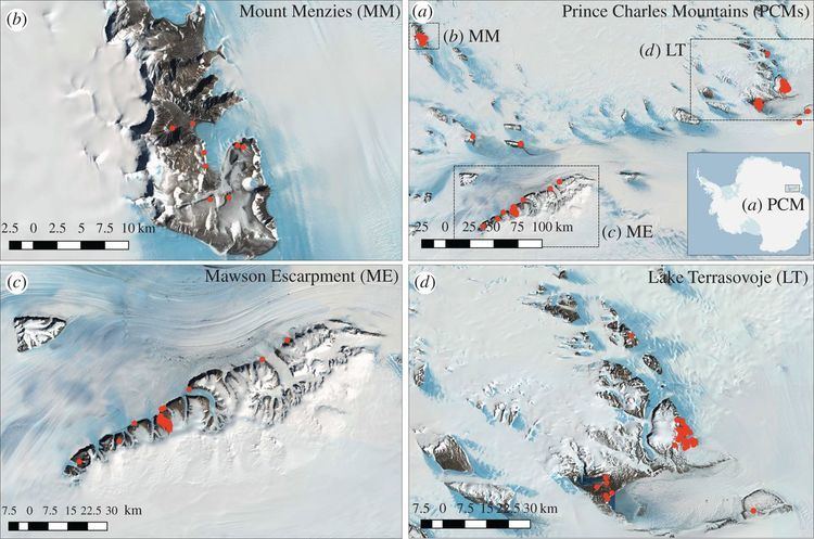
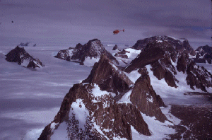
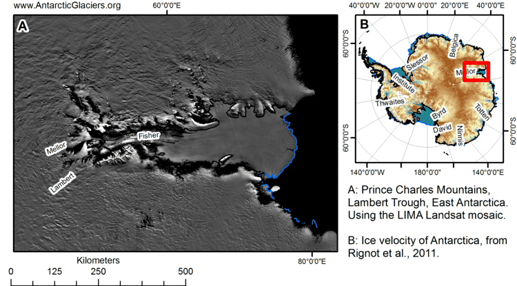
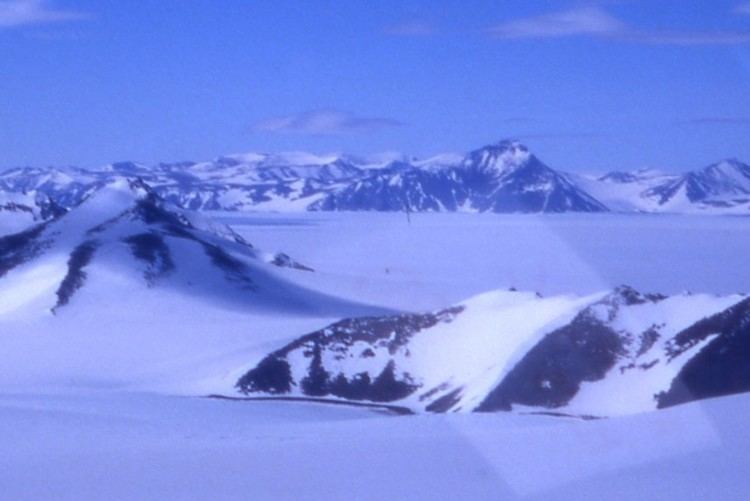
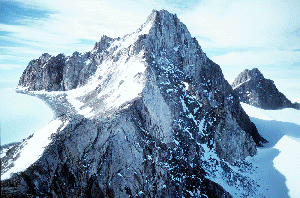
The Prince Charles Mountains are a major group of mountains in Mac. Robertson Land in Antarctica, including the Athos Range, the Porthos Range, and the Aramis Range. The highest peak is Mount Menzies (3228 m). Other prominent peaks are Mount Izabelle and Mount Stinear (1950 m). These mountains together with other scattered peaks form an arc about 260 miles long, extending from the vicinity of Mount Starlight in the north to Goodspeed Nunataks in the south.

Contents

Prince Charles Mountains Page 1 Geology of the Prince Charles Mountains

These mountains were first observed and photographed from a distance by airmen of USN Operation Highjump, 1946-47. They were examined by several ANARE (Australian National Antarctic Research Expeditions) parties and mapped in the years 1954-61. They have been found to contain large deposits of iron ore. They were named by ANCA in 1956 for Prince Charles, the eldest son and heir apparent of Queen Elizabeth II.

Prince Charles Mountains SSCUA photos

List of mountains

Prince Charles Mountains wwwpeterlensinknlPeaknpcm2gif

  • Mount Afflick (70°46′S 66°11′E) is a ridge-like mountain about 3 miles (5 km) west of Mount Bunt in the Aramis Range. Plotted from Australian National Antarctic Research Expeditions air photos taken in 1960. Named by ANCA for G.M. Afflick, weather observer at Mawson Station in 1965.
  • Mount Bayliss (73°32′S 62°44′E) is a relatively low mountain, extending 9 nautical miles (17 km) in an east-west direction, standing 6 nautical miles (11 km) east of Mount Menzies. Observed from ANARE aircraft in 1957 and seen in the same year by an ANARE ground party under K.B. Mather. Named by ANCA for E.P. Bayliss, Australian cartographer, who drew the map of Antarctica published in 1939 by the Property and Survey Branch, Dept. of Interior, Canberra.
  • Mount Bunt (70°46′S 66°22′E) is a sharp, conical peak, 2,315 metres (7,600 ft) high, which appears slightly truncated when viewed from the northwest, situated at the southwest end of a group of low peaks about 7 nautical miles (13 km) southeast of Mount Hollingshead in the Aramis Range. It was sighted in January 1957 by the Australian National Antarctic Research Expeditions southern party led by W.G. Bewsher, and named by the Antarctic Names Committee of Australia for J.S. Bunt, a biologist at Mawson Station in 1956.
  • Mount Cartledge (70°17′S 65°43′E) is a mountain just east of Mount Albion in the Athos Range. It was plotted from Australian National Antarctic Research Expeditions air photos of 1965, and named by the Antarctic Names Committee of Australia for W.J. Cartledge, plumber at Wilkes Station in 1962, and carpenter at Mawson Station in 1966.
  • Mount Gibson (71°20′S 66°20′E) is a small mountain about 2.5 nautical miles (4.6 km) west of Mount Cameron and 3 nautical miles (6 km) south of Schmitter Peak. Plotted from ANARE air photos taken in 1956 and 1960. Named by ANCA after P.R. Gibson, plumber at Wilkes Station in 1965.
  • Mount Izabelle (72°10′S 66°30′E) is a bare rock mountain standing 12 miles (19 km) southwest of the Shaw Massif. Discovered from an ANARE Beaver aircraft on November 28, 1956, while engaged in aerial photography. Named by ANCA for B. Izabelle, weather observer at Mawson Station in 1957.
  • Mount Meredith (71°12′S 67°45′E) is a fairly massive, almost flat-topped mountain standing 10 nautical miles (19 km) north of Fisher Massif. It was photographed from Australian National Antarctic Research Expeditions aircraft in 1956 and 1957, and was named by the Antarctic Names Committee of Australia for Sergeant N. Meredith, RAAF, an engine fitter at Mawson Station in 1957.
  • Mount Rymill (73°03′S 65°50′E) is a fairly massive mountain with an undulating surface marked by extensive formation of stone polygons, standing 6 mi W of Mount Stinear. Photographed from the air by ANARE, 1956-58. Named by ANCA for John Riddoch Rymill, leader of the British Graham Land Expedition, 1934-37.
  • Schmitter Peak (71°16′S 66°21′E) is a small mountain peak about 3 mi SW of Mount Woinarski. Plotted from ANARE air photos taken in 1956 and 1960. Named by ANCA for U. Schmitter, cook at Davis Station in 1964.
  • Shaw Massif (72°01′S 66°51′E) is a fairly flat-topped rock massif (1,355 m) on the west margin of Lambert Glacier standing 20 km (12 mi) south of Mount Willing. Sighted in November 1956 from an ANARE aircraft. Named by ANCA for Bernard Shaw, radio supervisor at Mawson Station in 1957.
  • Simon Ridge (71°03′S 65°30′E) is an arc-shaped rock ridge about 13 km (8 mi) southeast of Husky Massif. Plotted from ANARE air photos taken in 1960. Named for M.J. Simon, radio officer at Wilkes Station in 1962.
  • Mount Stinear (73°04′S 66°24′E) is a prominent rock peak on a large massif rising to 1,950 metres (6,398 ft), standing just east of Mount Rymill at the junction of Fisher Glacier and Lambert Glacier. It was mapped from air photos taken by the RAAF Antarctic Flight in 1956, and first visited in October 1957 by an ANARE party led by Bruce H. Stinear, geologist at Mawson Station, for whom it is named.
  • Namesakes

  • Mount Gibson, Western Australia

  • Prince Charles Mountains Agerelated environmental gradients influence invertebrate

    Prince Charles Mountains Page 1 Geology of the Prince Charles Mountains

    Prince Charles Mountains The Sirius Debate

    References

    Prince Charles Mountains Wikipedia