
- elevation 270 ft (82 m) Length 42 km Mouth Atlantic Ocean | - elevation 0 ft (0 m) | |
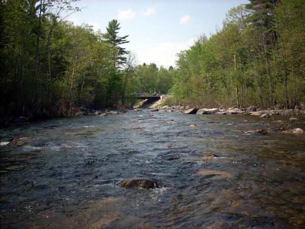 | ||
Polluted presumpscot river bank westbrook maine 2
The Presumpscot River is a 25.8-mile-long (41.5 km) river located in Cumberland County, Maine. It is the main outlet of Sebago Lake. The river provided an early transportation corridor with reliable water power for industrial development of the city of Westbrook and the village of South Windham.
Contents
- Polluted presumpscot river bank westbrook maine 2
- Map of Presumpscot River Falmouth ME USA
- CourseEdit
- Early industrial developmentEdit
- CanalEdit
- DamsEdit
- ConservationEdit
- References
Map of Presumpscot River, Falmouth, ME, USA
CourseEdit
The river flows through the communities of Standish, Windham, Gorham, Westbrook, Portland, and Falmouth before emptying into Casco Bay at Falmouth. The river is bridged by Maine State Route 35 between Standish and Windham, near North Windham, by the North Gorham to Windham Center road between Gorham and Windham, by the Maine Central Railroad Mountain Division between North Windham and South Windham, and by U.S. Route 202 in South Windham. The river is bridged again by the Maine Central Mountain Division in Westbrook and by U.S. Route 302 at Riverton between Westbrook and Portland. In Falmouth the river is bridged by the former Interstate 495, (now route 295); concurrent Maine State Routes 26 and 100, Interstate 95, Maine State Route 9, the Maine Central Railroad, Interstate 295, the Grand Trunk Railway, and U.S. Route 1.
Early industrial developmentEdit
Sawmills were built on the river during the 1660s. The first Maine paper mill was built on the river at Falmouth in 1731 by General Samuel Waldo.
CanalEdit
The river was an early transportation corridor between Casco Bay and Sebago Lake. A series of dams and locks were completed in 1830 to form the Cumberland and Oxford Canal. The canal operated until replaced by the Portland and Ogdensburg Railway in 1870. The canal lock system provided elevation control of the 45 square miles (117 km2) surface area of Sebago Lake as a reservoir for water-powered mills along the river. The S. D. Warren Paper Mill in Westbrook vied with the Oriental Powder Company in Gorham and Windham to control water flow after the canal ceased operation of the locks. The paper mill exercised control for more than half a century after the gunpowder factory closed in 1905.
DamsEdit
There are eight dams impeding the flow of the river as it makes its way to the ocean, some of which produce hydroelectric power. These dams are the Eel Weir Dam, North Gorham Dam, Dundee Dam, Gambo Dam, Little Falls Dam, Mallison Dam, Sacarappa Dam, and Cumberland Mills Dam. Since the removal of the Smelt Hill Dam in Falmouth in 2002, the last 7 miles (11 km) of the river after the Cumberland Mills Dam now flow unimpeded to the ocean.
ConservationEdit
The Presumpscot River Preserve, a 48-acre nature preserve, is located in North Deering alongside the Presumpscot River. It was purchased and preserved in 2001 by the Land for Maine's Future program as well as the City Land Bank Commission and Portland Trails.
In August 2014, Portland Trails preserved 20 acres of land in the Presumpscot River estuary in Falmouth around Mile Pond.