
Major highways NH-96, NH-236 Area 3,717 km² | Website Official website Major highway National Highway 330 | |
 | ||
Tehsils Raniganj, Kunda, Lalganj,Patti, Sadar | ||
The Pratapgarh district is one of the districts of Uttar Pradesh state of India, and Pratapgarh town is the district headquarters. The Pratapgarh district is a part of Allahabad division and lies between 25° 34' and 26° 11' latitudes while between 81° 19' and 82° 27' longitudes.
Contents
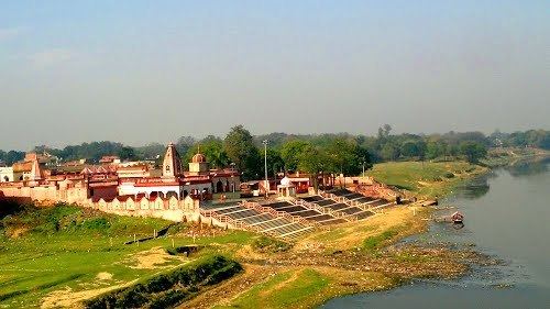
- Map of Pratapgarh Uttar Pradesh
- Full watch nukkad behes from pratapgarh up
- Economy
- Demographics
- Notable persons
- References
Map of Pratapgarh, Uttar Pradesh
Full watch nukkad behes from pratapgarh up
Economy
In 2006 the Ministry of Panchayati Raj named Pratapgarh one of the country's 250 most backward districts (out of a total of 640). It is one of the 34 districts in Uttar Pradesh currently receiving funds from the Backward Regions Grant Fund Programme (BRGF).
Demographics
According to the 2011 census Pratapgarh district, Uttar Pradesh has a population of 3,173,752, roughly equal to the nation of Mongolia or the US state of Iowa. This gives it a ranking of 109th in India (out of a total of 640). The district has a population density of 854 inhabitants per square kilometre (2,210/sq mi) . Its population growth rate over the decade 2001-2011 was 16.2%. Pratapgarh has a sex ratio of 994 females for every 1000 males, and a literacy rate of 73.1%.