
Time zone CST (UTC-6) Elevation 440 m Population 3,526 (2000) | Established 1829 GNIS feature ID 69797 Local time Saturday 3:53 PM Area code 479 | |
 | ||
Weather 9°C, Wind SW at 19 km/h, 91% Humidity Area 77.18 km² (76.92 km² Land / 26 ha Water) | ||
Prairie Township is one of thirty-seven townships in Washington County, Arkansas, USA. As of the 2000 census, its total population was 3,526.
Contents
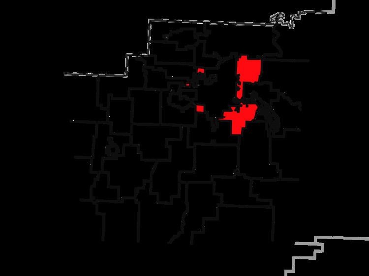
Map of Prairie Township, AR, USA
Geography
According to the United States Census Bureau, Morrow Township covers an area of 29.8 square miles (77 km2); with 29.7 miles (47.8 km) being land and the remaining 0.1 miles (0.16 km) being water. The township has been fragmented by the expansion of Fayetteville and thus Fayetteville Township. Prairie now consists of two main segments along Fayetteville's eastern edge and three very small segments on Fayetteville's west side.
The township gave part to Reed Township in 1880 and part to Wyman Township between 1890-1900.
Cities, towns, villages
Cemeteries
The township contains Hester Cemetery and St. Joseph Cemetery.
Major routes
References
Prairie Township, Washington County, Arkansas Wikipedia(Text) CC BY-SA