
Opening date April 1941 Height 49 m Catchment area 5,776 km² Create Prado Reservoir | Type of dam Earth-fill dam Length 2,280 ft (690 m) Opened April 1941 Surface area 26.71 km² | |
 | ||
Operator(s) U.S. Army Corps of Engineers Owner United States Army Corps of Engineers Similar Santa Ana River, Seven Oaks Dam, Prado Regional Park, Chino Creek, Santiago Creek | ||
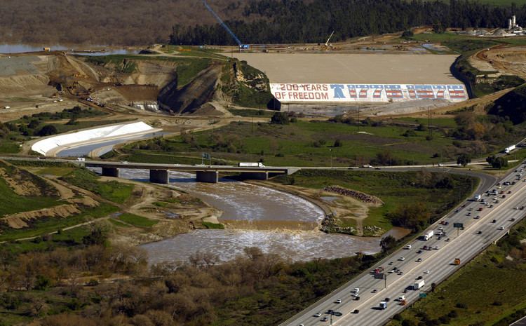
Prado Dam is an earth-fill dam across the Santa Ana River at the Chino Hills near Corona, California in Riverside County with the resulting impounded water creating Prado Flood Control Basin reservoir. The U.S. Army Corps of Engineers built the dam in Lower Santa Ana River Canyon. Its primary purpose is flood control and it is the downstream element of the Santa Ana River's flood control system, which is a natural constriction about 30.5 mi (49.1 km) upstream from the ocean. The area upstream from the dam contains 2,255 sq mi (5,840 km2) of the watershed's 2,650 sq mi (6,900 km2). The dam's construction was authorized in 1936 and the flood of 1938 demonstrated its necessity. Construction was completed in 1941. Prado Flood Control Basin also provides water storage for groundwater recharge operations.
Contents
Map of Prado Dam, Corona, CA 92880, USA
Failure threatEdit
On January 14, 2005, after days of heavy rain, water began seeping through an earthen extension. Authorities released water in order to relieve pressure and sent a flood warning to areas downriver of the dam. Over 3,000 residents were evacuated from their homes for nearly twenty-four hours for fear of flooding. The gymnasium at Corona High School was converted by the American Red Cross into a temporary shelter.
UpgradesEdit
As of 2005 work to increase the downstream channel's capacity from 5,000 to 30,000 cu ft (140 to 850 m3) per second is ongoing. The total costs of the improvements is estimated at $400 million.