Urban-type settlements 1 Founded 14 September 1939 | Area 22,670 km² | |
 | ||
Coat of arms of Pozharsky Municipal District Flag of Pozharsky Municipal District Anthem Anthem of Pozharsky District Administrative center | ||
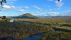
Pozharsky District (Russian: Пожа́рский райо́н) is an administrative and municipal district (raion), one of the twenty-two in Primorsky Krai, Russia. It is located in the northern and northwestern parts of the krai and borders with Khabarovsk Krai in the north, Terneysky District in the east and southeast, Krasnoarmeysky District in the south, Dalnerechensky District in the southwest, and with China in the west. The area of the district is 22,570.3 square kilometers (8,714.4 sq mi). Its administrative center is the urban locality (an urban-type settlement) of Luchegorsk. Population: 31,086 (2010 Census); 34,120 (2002 Census); 35,826 (1989 Census). The population of Luchegorsk accounts for 67.6% of the district's total population.
Contents
Map of Pozharsky District, Primorskiy Kray, Russia
History
The district was established on September 14, 1939 and is named after Ivan Pozharsky, a Hero of the Soviet Union who died during the Battle of Lake Khasan in 1938.
