
Demonym(s) Sangiorgesi Area 8.58 km² | Elevation 4 m (13 ft) Time zone CET (UTC+1) Local time Friday 6:24 PM Postal code 63822 | |
 | ||
Weather 14°C, Wind NE at 6 km/h, 80% Humidity | ||
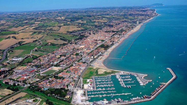
Porto San Giorgio is a comune (town or municipality) in the Province of Fermo, in the Marche region of Italy. It has approximately 16,500 inhabitants and it is located on the coast of the Adriatic Sea.
Contents
- Map of 63822 Porto San Giorgio Province of Fermo Italy
- Porto san giorgio estate 2016
- History
- Railways
- Landmarks
- People
- Twin towns
- References
Map of 63822 Porto San Giorgio, Province of Fermo, Italy
Porto san giorgio estate 2016
History
Already famous at the times of Pliny the Elder as Navale Firmanorum and cited by Strabo and in the Tabula Peutingeriana as Castrum Firmanorum (Citadel of Fermo), it was bound to the development of the port of Fermo, probably situated to the estuary of the Ete river and connected to the city of Fermo by the Pompeiana road.
Railways
The Porto San Giorgio-Fermo station is on the Ancona-Pescara railway line of the Ferrovie dello Stato.
Porto San Giorgio was connected to Amandola through a 56-kilometre (35 mi) narrow gauge railway with 950-millimetre (37 in) track, the so-called "Italian gauge", which was disabled in 1956.
Landmarks
The Chiesa di San Giorgio was completed in 1834.