
Country India Annual cargo tonnage 39.93 billion kg | Opened 1870 | |
Type of harbor Coastal breakwater, riverine, large seaport Main trades Automobiles, motorcycles and general industrial cargo including iron ore, granite, coal, fertilizers, petroleum products, and containersMajor exports: Iron ore, leather, cotton textilesMajor imports: Wheat, raw cotton, machinery, iron & steel Annual revenue 12.42 billion INR (US$180 million) Net income 702.4 million INR (US$10 million) Owners Ministry of Shipping, Government of India | ||
The Port of Kolkata (Bengali: কলকাতা বন্দর) is a riverine port in the city of Kolkata, India, located around 203 kilometres (126 mi) from the sea. It is the oldest operating port in India, and was constructed by the British East India Company.
Contents
- History
- Dock systems
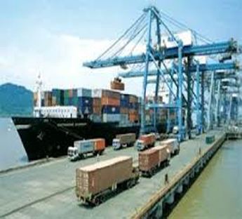
- Kolkata Dock System KDS
- Haldia Dock Complex HDC
- Dry Dock
- Pilotage
- Navigational Aids
- Operations
- Sister ports
- References
The Port has two distinct dock systems - Kolkata Docks at Kolkata and a deep water dock at Haldia Dock Complex, Haldia.
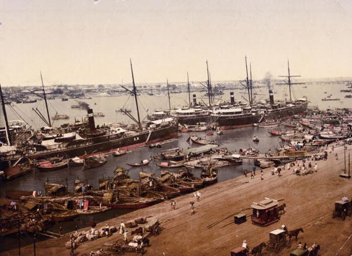
In the 19th century Kolkata Port was the premier port in British India. After independence its importance decreased because of factors including the Partition of Bengal (1905), reduction in size of the port hinterland and economic stagnation in eastern India.
It has a vast hinterland comprising the entire North East of India including West Bengal, Bihar, Jharkhand, Uttar Pradesh, Madhya Pradesh, Assam, North East Hill States and two landlocked neighbouring countries namely, Nepal and Bhutan and also the Autonomous Region of Tibet (China). With the turn of the century the volume of throughput has again started increasing steadily.
History
Kolkata Port was established by the British East India Company after the company received trading rights from the Mughal emperor Aurangzeb.
Following the shift of power from the company to the British crown, a port commission was set up in 1870. Though the port was conceived to be a commercial port and gateway of eastern India, the port played a very important role in the Second World War. It was bombed twice by the Japanese forces. After independence, the Commissioners for the Port of Kolkata were responsible for the port till January 1975 when Major Port Trusts Act, 1963, came into force. The Port is now run by a Board of Trustees having representatives from the Government, Trade Bodies, various Port Users, Labour Unions and some nominated members.
Dock systems
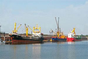
The Kolkata Port Trust (KoPT) manages two separate dock agglomerations - the Kolkata Dock System (KDS) and the Haldia Dock Complex (HDC).
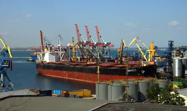
Kolkata Dock System (KDS)
It is situated on the left bank of the Hooghly River at 22°32′53″N 88°18′05″E about 203 km (126 mi) upstream from the sea. The pilotage station is at Gasper/ Saugor roads, 145 Kilometres to the south of the KDS (around 58 km from the sea). The system consists of:
Apart from this, there are around 80 major riverine jetties, and many minor jetties, and a large number of ship breaking berths.
Haldia Dock Complex (HDC)
It is situated at 22°02′N 88°06′E around 60 kilometres (37 mi) away from the pilotage station. The complex consists of:
All the docks are impounded dock systems with locks from river.
Dry Dock
KoPT has the largest dry dock facility in India . These dry docks cater to the diverse repair and maintenance needs of the vessels calling on the Eastern Ports of India. In addition, shipbuilding facilities are also available in these dry docks. All the dry docks are inside the impounded dock system. There are five dry docks of which three are in Kidderpore Dock and two are in Netaji Subhas Dock.
There is a fully-fledged repair workshop including Diesel Engine Overhauling Unit, Structural Shop, Heavy and Light Machine Shop, Forging Shop, Electrical Shop and a Chain Testing/Repair Shop with 2500 KN capacity Tensile Compression Testing Machine to support various activities in the dry dock. Kolkata Dry Dock & Workshop facilities have been awarded ISO 9001:2000 certificate in recognition of their excellence in quality.
Pilotage
Due to the constraints of the river (like silting, sandbars etc.) no seagoing vessel above 200 GRT is allowed to navigate without a qualified pilot of the Kolkata Port Trust. The total pilotage distance to KDS is 221 kilometres (137 mi), comprising 148 kilometres (92 mi) in river and 75 kilometres (47 mi) in sea, and for HDC is 121 kilometres (75 mi), comprising 46 kilometres (29 mi) in river and 75 kilometres (47 mi) in sea.
Navigational Aids
Lighthouse
Light Vessels
Automatic Tide Gauges
These are maintained at Tribeni, Garden Reach, Diamond Harbour and Haldia for round-the-clock recording of tidal data, which is used for the prediction of tides and preparation of tide tables by Survey of India.
Semaphores
These are maintained at Akra, Moyapur, Hooghly Point, Balari, Gangra and Sagar for displaying rises of tide for the convenience of various vessels navigating, dredging and surveying in the River Hooghly. The semaphores used to display the tide level at these localities on a mast by the position of the meter and decimeter arms which were manually rotated with the rise and fall of every decimeter of tidal level. However these semaphores are no longer functional and instead, tidal levels are broadcast over VHF radio every half an hour from all the above stations except at Balari.
River Marks and Buoys
A total of 500 (of which 140 are lighted) River Marks and Buoys are maintained by the KoPT. These are extremely useful in facilitating night navigation, pilotage and dredging. These lights are operated either by grid electricity, by battery or by dissolved Marine Acetylene Gas. There is also 1 boat buoy, 30 lighted buoys and 72 unlit buoys marking the navigational channel from Sandheads to Kolkata.
Differential Global Positioning System (Differential GPS)
In the wide estuary, position fixing with reference to shore objects to be viewed from the deck of a vessel, is very difficult. In 1983 KoPT introduced the Electronic Position Fixing System "Syledis" for position fixing of the vessels plying in the wide estuary of the Hooghly river. The Shore-based Syledis Position Fixing System was functioning round the clock with the help of the Syledis Stations located at Haldia, Raichak, Dadanpatra Bar and Frazergunj. The system was effectively utilized for the purpose of hydrographic survey and dredging. KoPT has now replaced the Syledis Position Fixing System by Differential GPS (Differential Global Position Fixing System). This latest state-of the art technology provides improved location accuracy of up to 10 cm.
Operations
In the fiscal year 2013-14, Kolkata port handled 41.386 million metric tons (45.620 million short tons) of cargo. This is significantly less than 53.143 million metric tons (58.580 million short tons) of cargo it handled in 2005-06. However, the number of vessels handled at Kolkata Port during 2013-2014 was the highest among all Indian Major Ports. KoPT handled 17.1% of the total number of vessels, which worked at Indian Major Ports in 2011-2012; significant improvement over 2011-12 which was 16%. During the fiscal year 2011-2012, 3183 vessels called at KoPT.
The average turn around time per vessel was 4.18 days for Kolkata Dock System and 3.37 for Haldia Dock Complex.