
Population 1,754 (2006 census) Postcode(s) 5212 Postal code 5212 | Established 1852 LGA(s) Alexandrina Council Founded 1852 Local time Friday 7:44 PM | |
 | ||
Weather 23°C, Wind S at 8 km/h, 69% Humidity Points of interest Horseshoe Bay, Basham Beach, Ladies Beach, Dump Beach, Knight Beach, Crockery Bay, Port Elliot obelisk | ||
Port Elliot is a town in South Australia toward the eastern end of the south coast of the Fleurieu Peninsula. It is situated on the sheltered Horseshoe Bay, a small bay off the much larger Encounter Bay. Pullen Island lies outside the mouth of the bay. At the 2006 census, Port Elliot had a population of 1,754, although this section of the coast is now built up almost all the way from Goolwa to Victor Harbor.
Contents
Map of Port Elliot SA 5212, Australia
History
Horseshoe Bay was proclaimed a port in 1851, and the settlement above the bay was named Port Elliot in 1852 after Charles Elliot, the Governor of Bermuda who was a friend of the then Governor of South Australia, Sir Henry Young. The location had been previously known as Freeman's Knob; the aboriginal name for the area may have been "Witengangool". The port was established to provide a safe seaport for the Murray river trade which terminated at Goolwa as the Murray Mouth was deemed too treacherous and unpredictable for safe navigation. Goods and passengers were carried between Goolwa and Port Elliot on the first public railway in Australia completed in 1854. The government works to establish the port included Australia's first reticulated water supply, from wells at Waterport (about 1 km north of the bay) to tanks above the jetty which provided fresh water for ships as well as for the town. In 1864 after a number of disastrous shipping losses in Horseshoe Bay the railway was extended to Victor Harbor which provided safer access for ships. Port Elliot's role as a port ended, with the bay and jetty being left to the fishermen and beachgoers. The importance of the rail link between the river and the sea soon also ended with the building of a railway between Adelaide and Morgan which enabled river traffic to offload freight and passengers over 260 kilometres (160 mi) further upstream and rail them directly to Adelaide. The towns of the southern Fleurieu coast – Victor Harbor, Port Elliot, Middleton and Goolwa – were spared any further commercial or industrial development, and became a popular holiday destination with many guest houses, camping parks and 'weekender' houses and shacks. The nearby early subdivisions of Waterport, Louisville, Findon, Ville St.Louis and Elliot Town are now all considered part of Port Elliot.
Recent times
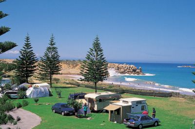
Today, Port Elliot is a quiet township with two hotels, three churches, six coffee shops, no fast food chains, and is a popular holiday destination close enough to Adelaide for day trippers and even commuters. The continuing expansion of the Greater Adelaide metropolitan area together with ongoing improvements to the road links between the Southern Fleurieu and Adelaide has brought an influx of "seachange retirees", driving up house and land prices, and adversely affecting the ability of local young people and families to remain in the area. Employment prospects are largely limited to hospitality work, aged care and the building trades which continue to benefit from rapid growth in the region. In 2008 Port Elliot became the focus of unwanted media attention due to the murder of 15-year-old Carly Ryan at Lady Bay. On 21 January 2010, a 50-year-old man from Victoria was found guilty of the murder while his son was found not guilty.