
Population 1,440 (2011) Local time Friday 7:08 AM | OS grid reference SS886467 Post town MINEHEAD Dialling code 01643 | |
 | ||
Weather 7°C, Wind NE at 29 km/h, 92% Humidity Points of interest Dovery Manor Museum, Hawkcombe Woods, The Boat Shed Museum | ||
Scenic north devon drive lynton to porlock and allerford
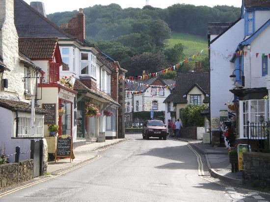
Porlock is a coastal village in Somerset, England, 5 miles (8 km) west of Minehead. It has a population of 1,440.
Contents
- Scenic north devon drive lynton to porlock and allerford
- Map of Porlock Minehead UK
- A walk down into porlock village from exmoor
- History
- Governance
- Geography
- Submerged forest
- Church
- References
Map of Porlock, Minehead, UK
In 2010, Porlock had the most elderly population in Britain, with over 40% being of pensionable age.
A walk down into porlock village from exmoor
History
East of the village is Bury Castle, an Iron Age hill fort.
There is evidence for 10th or 11th century origin for the name Porlock as Portloc or Portloca meaning enclosure by the harbour, from the Old English 'port' and 'loca' . and in the Domesday Book the village was known as "Portloc". '. [1] Porlock was part of the hundred of Carhampton.
The area has links with several Romantic poets, and R. D. Blackmore, the author of Lorna Doone, and is popular with visitors. The visitor centre has exhibits and displays about the local area. Also on display are the bones of an aurochs, discovered on Porlock beach in 1999.
Governance
The parish council has responsibility for local issues, including setting an annual precept (local rate) to cover the council’s operating costs and producing annual accounts for public scrutiny. The parish council evaluates local planning applications and works with the local police, district council officers, and neighbourhood watch groups on matters of crime, security, and traffic. The parish council's role also includes initiating projects for the maintenance and repair of parish facilities, as well as consulting with the district council on the maintenance, repair, and improvement of highways, drainage, footpaths, public transport, and street cleaning. Conservation matters (including trees and listed buildings) and environmental issues are also the responsibility of the council.
The village falls within the Non-metropolitan district of West Somerset, which was formed on 1 April 1974 under the Local Government Act 1972, having previously been part of Williton Rural District. The district council is responsible for local planning and building control, local roads, council housing, environmental health, markets and fairs, refuse collection and recycling, cemeteries and crematoria, leisure services, parks, and tourism.
Somerset County Council is responsible for running the largest and most expensive local services such as education, social services, libraries, main roads, public transport, policing and fire services, trading standards, waste disposal and strategic planning.
As Porlock falls within the Exmoor National Park some functions normally administered by district or county councils have, since 1997, fallen under the Exmoor National Park Authority, which is known as a ‘single purpose’ authority, which aims to "conserve and enhance the natural beauty, wildlife and cultural heritage of the National Parks" and "promote opportunities for the understanding and enjoyment of the special qualities of the Parks by the public", including responsibility for the conservation of the historic environment.
Porlock has an electoral ward called 'Porlock and District' but this stretches westwards to the Devon boundary,eastwards to Minehead and south to Wootton Courtenay. The total population of the ward at the 2011 cenus was 2,338.
It is also part of the Bridgwater and West Somerset county constituency represented in the House of Commons of the Parliament of the United Kingdom. It elects one Member of Parliament (MP) by the first past the post system of election, and part of the South West England constituency of the European Parliament which elects seven MEPs using the d'Hondt method of party-list proportional representation.
Geography
The village adjoins the Porlock Ridge and Saltmarsh nature reserve, created from the lowland behind a high shingle embankment which was breached by the sea in the 1990s, which has now been designated as a Site of Special Scientific Interest. Copses of white dead trees remind the visitor of when this was freshwater pasture.
A stream flows down a wooded combe called Hawkcombe leads about three miles (5 km) from the village up to high open moorland. The stream, called "Hawkcombe Waters", runs past a Victorian hunting lodge, called The Cleeve, then underground beneath the Overstream Hotel in the centre of the village.
The South West Coast Path goes through Porlock, many walkers stopping rather than continuing the long walk to Lynton. There is also a 'Coleridge Way' walk.
Culbone Church is said to be the smallest church in England. The main structure is 12th century. Services are still held there, despite the lack of road access – Culbone is a two-mile (3 km) walk from Porlock Weir, and some 3–4 miles (about 6 km) from Porlock itself.
A toll road bypasses the 1 in 4 gradient on Porlock Hill. There is the prehistoric Porlock Stone Circle on the hill.
Submerged forest
At low tide the remains of a submerged forest can be seen on Porlock Beach. The area was several miles inland until the sea level in the Bristol Channel rose about 7000 to 8000 years ago.
Church
The Church of St Dubricius dates from the 13th century. The spire was damaged in a storm of 1703. The church has been designated by English Heritage as a grade I listed building. Within the church is a 15th-century tomb of John Harrington who fought alongside Henry V in France in 1417.