
- elevation 126 m (413 ft) Basin area 118,000 km² Basin area 61,400 km² | Length 916 km Discharge 650 m³/s | |
 | ||
- average 414 m/s (14,620 cu ft/s) | ||
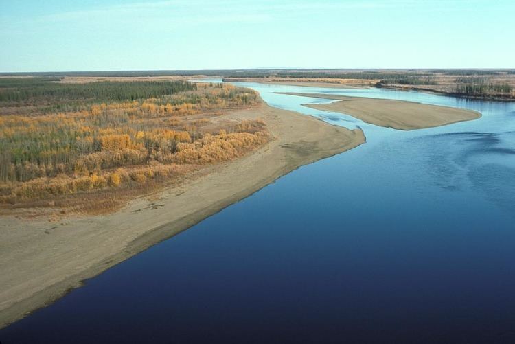
The Porcupine River (Ch’ôonjik in Gwich’in) is a 916-kilometre (569 mi) tributary of the Yukon River in Canada and the United States. It begins in the Ogilvie Mountains north of Dawson City, in the Yukon territory of Canada. From there it flows north through the community of Old Crow, veers southwest into the U.S. state of Alaska, and enters the larger river at Fort Yukon. It derives its name from the Gwich'in word for the river, Ch'oonjik, or "Porcupine Quill River".
Contents
Map of Porcupine River, Alaska, USA
The Porcupine caribou herd, in the Arctic National Wildlife Refuge (ANWR) Alaska, gets its name from the river.
The oldest (but disputed) possible evidence of human habitation in North America was found in a cave along one of its tributaries, the Bluefish River. A large number of apparently human-modified animal bones have been discovered in the Bluefish Caves. They have been dated to 25,000 to 40,000 years old by carbon dating—several thousand years earlier than generally accepted human habitation of North America.
Boating
The Porcupine River offers the possibility of "an excellent novice river trip for those experienced in remote wilderness travel," according to author Karen Jettmar. Boaters can travel by canoe, kayak, or raft, though rafters may have difficulty with upriver winds. An 800-kilometre (500 mi) float trip beginning at Summit Lake in the Yukon Territory, descending the Bell River to its confluence with the Porcupine, and continuing to Fort Yukon is all rated Class I (easy) on the International Scale of River Difficulty. However, in high water the difficulty may rise to Class II in Upper and Lower Rampart canyons, downstream of the international border, where the current is swift.