
Elevation 2,362 m | Territories Yukon | |
 | ||
Mountains Eureka Dome, Mount Frank Rae, Mount Harper | ||
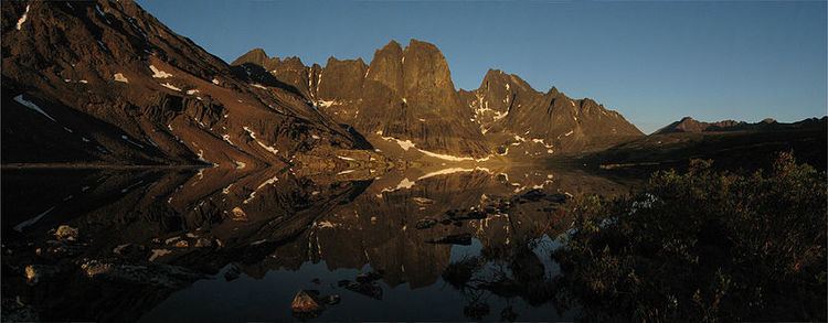
Ogilvie mountains
The Ogilvie Mountains are a mountain range in the Yukon Territory of northwestern Canada.
Contents
- Ogilvie mountains
- Map of Ogilvie Mountains Yukon Unorganized Yukon Canada
- Yukon dempster blick auf ogilvie mountains juni 2015
- Geography
- Peaks
- References
Map of Ogilvie Mountains, Yukon, Unorganized, Yukon, Canada
Geologically they are part of the Yukon Ranges, in the upper Laramide Belt of the North American Cordillera.
Yukon dempster blick auf ogilvie mountains juni 2015
Geography
The range lies north of Dawson City, and is crossed by the Dempster Highway.
The area was first surveyed by William Ogilvie and the range subsequently named after him.
Peaks
The best known mountain peaks of the Ogilvie Mountains are located within Tombstone Territorial Park .
The highest mountain within the range is Mount Frank Rae, at 2,362 m (7,749 ft) in elevation.
The range's most familiar mountains, with their jagged granite peaks, are:
References
Ogilvie Mountains Wikipedia(Text) CC BY-SA