
Elevation 390 m (1,280 ft) Area 4,820 km² | Microregion Porangatu Time zone BRT/BRST (UTC-3/-2) | |
 | ||
Parangatu is a town in Goiás state, Brazil.
Contents
- Map of Porangatu State of GoiC3A1s Brazil
- Geography
- History
- Political information
- Demographic information
- Economic information
- Agricultural Data 2006
- Education 2006
- Health 2007
- Municipal Human Development Index 2000
- Seplan Economic Development Index
- Seplan Social Development Index
- References
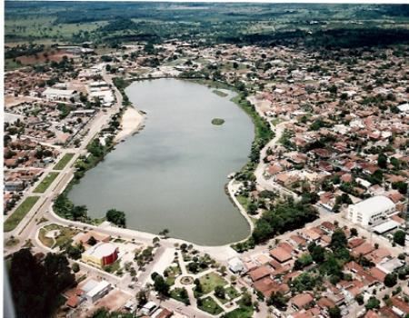
Map of Porangatu - State of Goi%C3%A1s, Brazil
Geography
Parangatu is in its own microregion, Porangatu Microregion, of 226,766 inhabitants in an area of 35.287 km²; 426 km from the state capital, Goiânia. This microregion serves as a nucleus for eighteen municipalities in the north of Goiás state. The municipal seat is just west of the important interstate highway BR-153, which connects Belém with Brasília and just south of the state line with the recently created state of Tocantins.
Important rivers are the Santa Tereza, Cana Brava, Ouro Pintado, Santa Maria and Gregório. The climate is hot, moist tropical, with frequent occurrences of a maximum of 40 °C. The average minimum is 21C, the maximum is 40 °C and the minimum is 21 °C. The elevation is 390 meters above sea level and the highest points are Serra da Sabina and Serra dos Picos.
History
The first settlement began in the eighteenth century with the discovery of gold in the region. Attacks from the local Indians, the Canoeiros, kept the settlement, called Descoberto, from developing. Until 1933 it was a district belonging to Pilar de Goiás, when it became part of the municipality of Santana, later changed to Uruaçu. In 1943 Descoberto was changed to Porangatu, from Tupi-Guarani, meaning "poran", beautiful, and "gatu", landscape. In 1948 it was dismembered from Uruaçu. With the building of the Belém to Brasília highway (BR-153) in 1958 Porangatu grew quickly to become the most important commercial center of this new region that was opening up to migrants from the south.
Political information
Demographic information
Economic information
The economy is based on agriculture, cattle raising, services, public administration, and small transformation industries.
Most of the economy is dependent on cattle raising and agriculture, but in recent years the region has attracted medium size industries. Porangatu is today the commercial center for the north of Goiás receiving people from all the neighboring region to buy its products. Commerce employed 2,065 people in 2005.
(August 2007)
Agricultural Data (2006)
Education (2006)
Health (2007)
Municipal Human Development Index 2000
Seplan Economic Development Index
The ranking was 110 out of 246 municipalities. See Seplan
Seplan Social Development Index
The ranking was 120 out of 246 municipalities. See Seplan