
Country Thailand Postal code 22140 Area 927 km² Province Chanthaburi Province | Time zone ICT (UTC+7) Geocode 2204 Population 38,115 (2005) | |
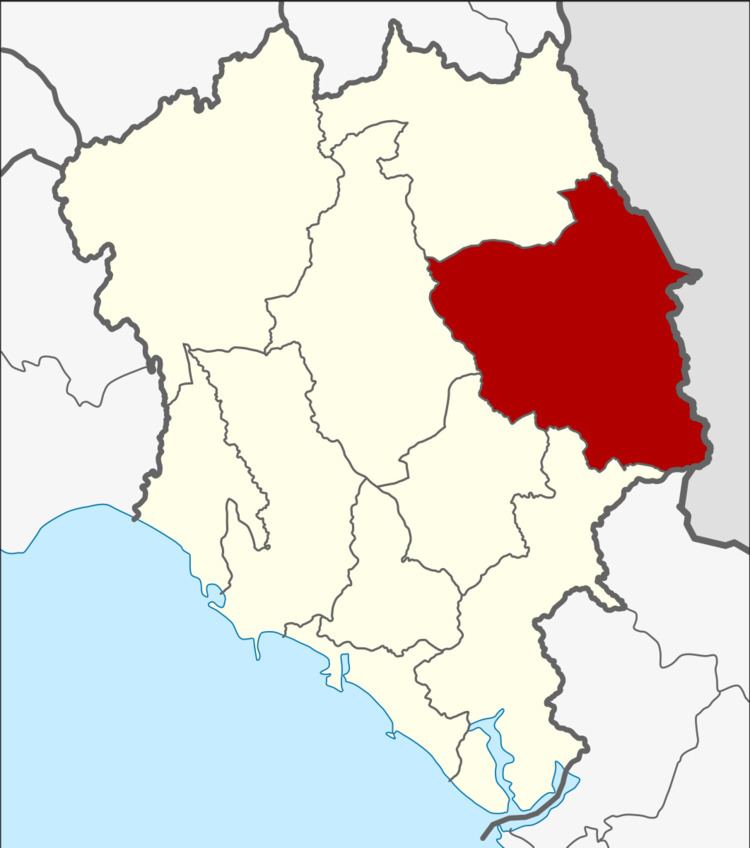 | ||
Pong Nam Ron (Thai: โป่งน้ำร้อน, [pòːŋ nám rɔ́ːn]) is the easternmost district (amphoe) of Chanthaburi Province, eastern Thailand.
Contents
Map of Pong Nam Ron District, Chanthaburi, Thailand
Geography
Neighboring districts are (from the southwest clockwise) Khlung, Makham, Khao Khitchakut and Soi Dao of Chanthaburi Province. To the east are Battambang and Pailin of Cambodia.
There are two border crossings into Cambodia in Pong Nam Ron. One is at Ban Pakkard (or Ban Phak Kat) in Klong Yai tambon. The Cambodian town across the border is Phrom in Pailin municipality. The second crossing is at Ban Laem in Thep Nimitr tambon. The Cambodian village across the border is Daun Lem in Kamrieng district, Battambang Province.
History
The minor district (King Amphoe) Pong Nam Ron was upgraded to a full district on 25 July 1941.
Administration
The district is subdivided into 5 subdistricts (tambon), which are further subdivided into 47 villages (muban). Pong Nam Ron is a township (thesaban tambon) which covers parts of tambon Pong Nam Ron and Thap Sai. There are further 5 tambon administrative organizations (TAO).
Missing numbers are tambon which now form Soi Dao district.