
Country United States ZIP code 13138, 13078, 13104 Elevation 444 m Local time Thursday 2:09 PM | State New York Time zone Eastern (EST) (UTC-5) FIPS code 36-59036 Population 7,080 (2010) Area code 315 | |
 | ||
Weather -2°C, Wind W at 10 km/h, 36% Humidity Area 172.2 km² (172 km² Land / 26 ha Water) | ||
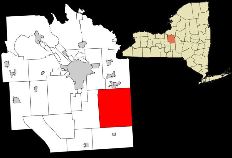
Pompey is a town in the southeast part of Onondaga County, New York, United States. The population was 7,080 at the 2010 census. The town was named after the Roman general and political leader Pompey by a late 18th-century clerk interested in the Classics in the new federal republic.
Contents
- Map of Pompey NY 13084 USA
- History
- School districts
- Notable people
- Geography
- Demographics
- Communities and locations in Pompey
- References
Map of Pompey, NY 13084, USA
History
The area of Pompey was originally part of the territory traditionally occupied by the historic Onondaga, one of the Five Nations of the Iroquois tribes of the powerful Haudenosaunee, or Iroquois Confederacy. After the American Revolutionary War, when most of the Iroquois were forced to cede their land to the victorious United States, many of the Onondaga migrated to Canada. The British Crown awarded them land there for resettlement for their support during the war. New York State took over the former Iroquois lands and sold much of the public land for development (and speculation). It reserved part as the Central New York Military Tract. Veterans of the Revolution were awarded land grants in this tract as payments for service. The town was first settled by outsiders around 1789, as Yankees from New England and other migrants moved into western New York.
The town of Pompey was formed in 1789, but not completely organized until 1794, when Onondaga County was established. The original town was divided and sub-divided into many other towns in the region, including all of the towns of Fabius (1798), Tully, Preble, and Scott (the latter two now in Cortland County), along with parts of the towns of Spafford, Otisco (1806), LaFayette (1825), Onondaga (1794), Truxton and Cuyler (the latter two now in Cortland County).
The hamlet of Pompey developed about 10.5 miles (17 km) south of the main east-west Native American trail across the state, used for generations. European-American settlers improved the trail and developed it as the Genesee Road (1794) and then the Seneca Turnpike (1800), running through the villages of Cazenovia, Manlius and Onondaga Hollow (south of Syracuse). The segment of modern U.S. Route 20 (US 20), which connects Cazenovia and Skaneateles by way of Pompey and LaFayette, was not built until 1934.
The Oran District No. 22 Schoolhouse and Drover's Tavern at Oran are listed on the National Register of Historic Places.
School districts
The town of Pompey covers part of four separate public school districts:
Notable people
Geography
According to the United States Census Bureau, the town has a total area of 66.5 square miles (172 km2), of which, 66.4 square miles (172 km2) of it is land and 0.1 square miles (0.26 km2) of it (0.09%) is water.
The town is south of Syracuse. The east town line is the county line of Madison County.
US 20 is an east-west highway through the town. New York State Route 91 (NY 91), a north-south highway, intersects US 20 in Pompey hamlet. NY 92 cuts across the northwest corner of Pompey.
Demographics
As of the census of 2000, there were 6,159 people, 2,154 households, and 1,761 families residing in the town. The population density was 92.7 people per square mile (35.8/km²). There were 2,272 housing units at an average density of 34.2 per square mile (13.2/km²). The racial makeup of the town was 97.56% White, 0.37% African American, 0.21% Native American, 0.96% Asian, 0.28% from other races, and 0.62% from two or more races. Hispanic or Latino of any race were 0.70% of the population.
There were 2,154 households out of which 41.4% had children under the age of 18 living with them, 72.4% were married couples living together, 5.5% had a female householder with no husband present, and 18.2% were non-families. 14.7% of all households were made up of individuals and 5.6% had someone living alone who was 65 years of age or older. The average household size was 2.86 and the average family size was 3.17.
In the town, the population was spread out with 29.6% under the age of 18, 4.4% from 18 to 24, 27.8% from 25 to 44, 28.2% from 45 to 64, and 10.1% who were 65 years of age or older. The median age was 39 years. For every 100 females there were 99.4 males. For every 100 females age 18 and over, there were 98.2 males.
The median income for a household in the town was $59,190, and the median income for a family was $64,442. Males had a median income of $42,212 versus $32,357 for females. The per capita income for the town was $27,970. About 2.5% of families and 3.9% of the population were below the poverty line, including 5.4% of those under age 18 and 2.2% of those age 65 or over.