
Basin size 140 km (54 sq mi) | Length 19 km | |
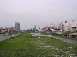 | ||
River mouth | ||
The Polcevera (in Ligurian Pûçéivia o Ponçéivia) is a 19-kilometre (12 mi) stream of Liguria (Italy).
Contents
Map of Torrente Polcevera, Genoa, Italy
Geography
The river is named Polvecera from Pontedecimo, at the confluence of torrente Riccò (left hand) and torrente Verde (right hand). Between Pontedecimo and the Ligurian Sea Polcevera's length is 11 km, but considering the Verde its total length is 19 km.
From Pontedecimo the Polcevera heads south and receives at Bolzaneto the waters of torrente Secca, another important left hand tributary. It ends its course in the Ligurian Sea between Sampierdarena and Cornigliano, two quartieri of Genoa.
The 140 km2 (54 sq mi) drainage basin of the Polcevera is totally included in the Province of Genova. Its highest point is Monte Taccone (1.113 m).
Main tributaries
History
The Département du Polcevera o Dipartimento della Polcevera of Ligurian Republic took its name at the end of the XVIII century from the stream.