
Parent range Ligurian Appennines Elevation 1,113 m Mountain range Apennine Mountains | First ascent ancestral Province Province of Alessandria Easiest route Hiking | |
 | ||
Similar Monte delle Figne, Monte Leco, Piani di Praglia, Monte Figogna, Monte Pracaban | ||
Monte taccone
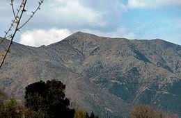
Monte Taccone is a mountain located between Liguria and Piedmont in north-western Italy. It is part of the Ligurian Appennines.
Contents
- Monte taccone
- Map of Monte Taccone 15060 Voltaggio Province of Alessandria Italy
- Access to the summitEdit
- Nature conservationEdit
- References
Map of Monte Taccone, 15060 Voltaggio, Province of Alessandria, Italy
Access to the summitEdit
The mountain is accessible by signposed foothpaths departing from Bocchetta Pass or Isoverde (municipality of Campomorone).
The Alta Via dei Monti Liguri, a long-distance trail from Ventimiglia (province of Imperia) to Bolano (province of La Spezia), passes very close to the mountain's summit.
Nature conservationEdit
The northern slopes of Monte Taccone are included in the Capanne di Marcarolo natural park.
References
Monte Taccone Wikipedia(Text) CC BY-SA