
Max. depth 46 m (151 ft) | Catchment area 1 ha | |
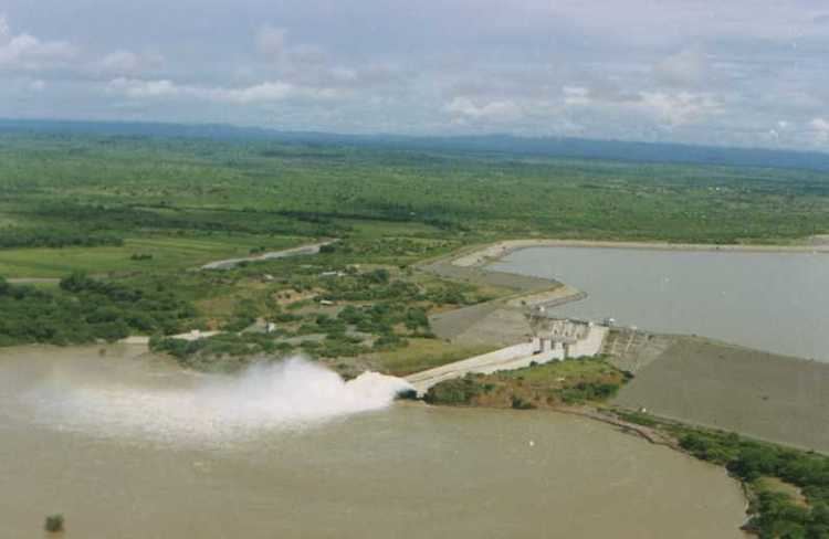 | ||
Poechos Reservoir is a middle-sized reservoir on Peru's Chira River in the border area between Peru and Ecuador. Its purpose is to improve the accumulation of water stocks in the upper part of Peru's Chira basin by flood control, irrigation, drainage and electricity generation.
Contents
- Map of Embalse Poechos Peru
- Location
- History
- Phase 1 1970 to 1977
- Phase 2 1978 to 1985
- Phase 3 1985 to 1997
- Phase 4 2002 to 2004
- Capacities
- References
Map of Embalse Poechos, Peru
Location
The Poechos Reservoir is situated in the northernmost part of Peru, in the lower flow of the rivers Chira and Piura, about 50 km north of Piura, the capital of the Piura Region. It is located on 4° 3' southern latitude and 80° 2' western longitude at an altitude of 98 m in the Lancones district of the province of Sullana, approximately 30 km from the border with Ecuador.
History
The system was built in four phases:
Phase 1 (1970 to 1977)
The first phase included the construction of
Phase 2 (1978 to 1985)
The second phase covered
Phase 3 (1985 to 1997)
The third phase consisted of
Phase 4 (2002 to 2004)
The final phase included
Capacities
The capacity of the reservoir is 1,000,000,000 m³, its catchment area 14,000 m², its maximum depth 46 m.
The irrigation dam is 49 m high and 9 km wide at crest and at its bottom has a conduit to discharge water at a rate of 4 m³/s.
The original design brief was to revitalise the Piura valley, which was short of water, and provide modern irrigation for approximately 350 km² of arable land.
The Poechos I Hydroelectric Plant is operated by Sindicato Energético S.A (SINERSA). The Poechos I power house has 15.4 MW in installed capacity and generates 60 GW·h annually for Electronoroeste, the concessionary for energy distribution in northwestern Peru. The power plant is to accomplish a 90% national electrification level of the country by the year 2010 by using a zero emission energy source.