
Postal code 730 14 Area 495.4 km² Local time Tuesday 3:06 PM | Time zone EET (UTC+2) Vehicle registration ΧΝ, XB Elevation 10 m Area code 28210 | |
 | ||
Weather 18°C, Wind SE at 18 km/h, 77% Humidity | ||
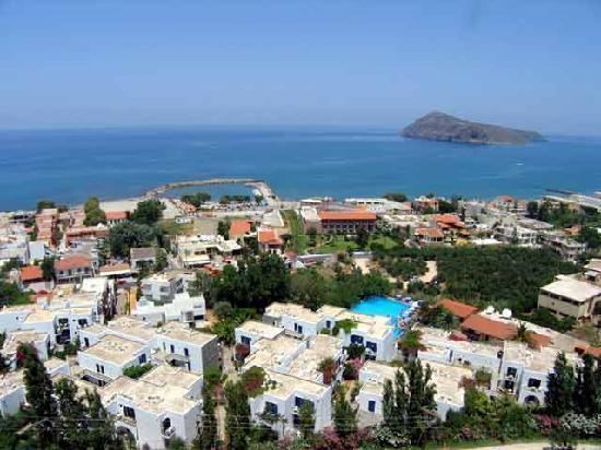
Porto platanias beach resort spa crete island girit adas
Platanias (Greek: Πλατανιάς) is a village and municipality on the Greek island of Crete. It is located about 10 km (6.2 mi) west from the city of Chania and east of Kastelli-Kissamos, on Chania Bay. The seat of the municipality is the village Gerani. Platanias is a popular tourism village with a beach, several hotels, restaurants and souvenir shops. Not far from the coast is the island of Agioi Theodoroi.
Contents
- Porto platanias beach resort spa crete island girit adas
- Map of Platanias 730 14 Greece
- Municipality
- References
Map of Platanias 730 14, Greece
Municipality
The municipality Platanias was formed at the 2011 local government reform by the merger of the following 4 former municipalities, that became municipal units:
The municipality has an area of 491.780 km2 (189.877 sq mi), the municipal unit 74.932 km2 (28.931 sq mi).
It lies within the Chania regional unit and is numbered 6 on the map of the Chania region. It is on the north coast, forming the eastern shore of Kissamos Bay (Kolpos Kissamou Kόλπος Κισσάμου), and the west and south shores of Chania Bay (Kolpos Chanion Κόλπος Χανίων). It is bordered by Kissamos (5) to the west, Kantanos-Selino (4) to the south, Chania (1) to the east, and Sfakia (7) in the southeast. Its northeast region is the Rodopos Peninsula (Chersonisos Rodopou Χερσόνησος Ροδωπού).