
Founded June 16, 1962 Time zone PST (UTC+8) Population 10,935 (2015) Local time Tuesday 7:12 PM | Barangays Area 35.05 km² Dialling code 42 | |
 | ||
Weather 26°C, Wind NE at 14 km/h, 87% Humidity | ||
Plaridel quezon kami 3
Plaridel is a fifth class municipality in the province of Quezon, Philippines. According to the 2015 census, it has a population of 10,935 people. The municipality was created in 1962 by virtue of Republic Act 3493, its territories carved out from Atimonan.
Contents
- Plaridel quezon kami 3
- Map of Plaridel Quezon Philippines
- Grpc gcpc plaridel quezon training toss south 2013
- Geography
- Barangays
- Religion
- Local government
- References
Map of Plaridel, Quezon, Philippines
Grpc gcpc plaridel quezon training toss south 2013
Geography
The smallest municipality in the province of Quezon, Plaridel has an area of 33 square kilometers comprising nine barangays - four of which are poblaciones - and its population is around 11,000. It lies between the towns of Atimonan and Gumaca, hugging the coastline of the Province alongside Maharlika Highway. Its inhabitants are occupied primarily with fishing. Those engaged inAgriculture plant mostly coconut and rice. A visitor this town must taste and savor its local version of Suman.
Barangays
Plaridel is politically subdivided into 9 barangays.
Barangays Duhat, Ilaya, and Ilosong are south of the Poblacion, and are accessed by a paved road which connects with the National Maharlika Highway at Brgy. Pampaaralan (also called Paaralan). This road is also the main access to Brgy. Kulawit, part of the Municipality of Atimonan to the west.
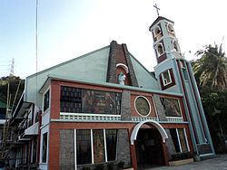
Religion
Local government
Elected officials 2013-2016: