
Population 2,696 Post town AIRDRIE Local time Tuesday 6:41 AM | OS grid reference NS798699 Sovereign state United Kingdom Postcode district ML6 Dialling code 01236 Scottish parliament Airdrie and Shotts | |
 | ||
Weather 0°C, Wind SW at 34 km/h, 96% Humidity Lieutenancy areas North Lanarkshire, Lanarkshire | ||
Plains /ˈpleɪnz/ is a village outside the town of Airdrie, in North Lanarkshire, Scotland, about 14 miles east of Glasgow city centre and 32 miles west of Edinburgh. The nearest major towns are Airdrie (2.5 miles) and Coatbridge (5 miles).
Contents
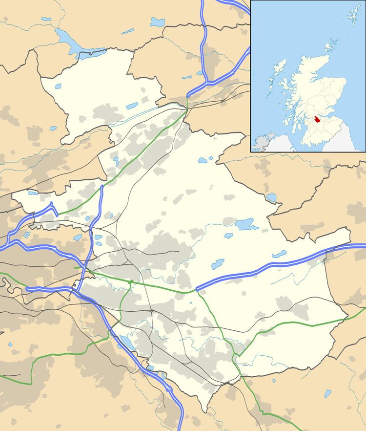
- Map of Plains Airdrie UK
- Etymology
- Geography
- History
- Plains today
- Organised religion
- Education
- Points of interest
- References
Map of Plains, Airdrie, UK
Etymology
The origin of the name "Plains" is unknown. One suggestion is that the name derives (via the plural of Plain) from the view afforded to the Cistercian Monks of Newbattle Abbey as they travelled to what is now the site of the village. These monks farmed the wider area for grain in what became known as Monklands. But the geography of the area runs contrary to this idea. Alternatively, the name may be a contraction of "The Plains of Waterloo" - a name given by a returning soldier from the Napoleonic wars.[1] Either way, it is not uncommon for locals to refer to the village as "The Plains".
Somewhat mistakenly, locals (and predominantly Standard Grade Spanish students), have referred to the village as Las Vegas; however, this is an incorrect translation of the Spanish, in which the literal translation of the Nevada gambling town is The Meadows. For those who grew up in the new housing (to the North) of the late 1960s, this alternative translation would have equal merit looking from Craiglea Terrace, west towards The Quarry across the cattle fields. It is not clear, however, which of these two settlements was established first. Locals do concede, however, that within the two, gambling is probably more difficult in the village after the Ladbrokes bookies was closed some time in the 1990s.
There is no known association to any other place called Plains. But in 1976, newly elected US President Jimmy Carter (of Plains, Georgia) received a congratulatory telegram from Plains newsagent - also J. Carter. Thus the family "the Carters of Plains" were featured in the Scottish national tabloid, The Daily Record. There is no known connection between later American presidents and the village.
Geography
The Plains is situated on the gentle south facing slope of the valley of the North Calder Water, which is a tributary of the River Clyde. To the north of the settlement runs a series of unclassified roads known to older residents as The Backies. Opencast mining in the 1970s and 1980s took away much of the natural beauty within this network of roads which since has further been eroded with the advent of a landfill site.
The Main Street (the A89) runs in a straight line for about 1 mile east to west. Almost all of the residential housing of the village lies on the northern side of Main St., forming a roughly square shape (1 mile each side). To the south of Main St., the valley drops more steeply down to the North Calder, then steeply up the other side, which is home to the parkland Easter Moffat golf course. This course is widely appreciated for the picturesque 18th hole, which tees from the lower reaches of Annieshill to the charming clubhouse.
The Plains lies at around 500 ft above sea level. From the nearby Airdriehill Farm, there is a wide vista to the west across the urbanised lower Clyde valley. Beyond, on a clear day, it is possible to see Ben Lomond and the Isle of Arran. Airdriehill was the source of endless excitement to village children in the 1970s with loud explosions cascading across the village as quarriers pursued the rich seam of hard rock available there. Graffiti at the west site entrance, pointing to the existence of a nuclear bunker at this now exhausted site, has never been substantiated.
To the south-east of The Plains, the land rises to almost 1000 feet – the highest land in the narrow isthmus across central Scotland - Scotland's "Continental Divide". Consequently, the area was chosen as the location for Scotland's first television transmitting stations. The Black Hill Transmitter, at 1000 ft tall, is a very prominent local landmark. It began broadcasting independent Scottish Television services in August 1957. Nearby, but not so tall or prominent, is Kirk o'Shotts transmitter mast, which broadcast Scotland's first BBC television signals in March 1952. There is now a second transmitter (completed 2009) which will replace the older one, which itself will be relocated within the Scottish transmitting network.
History
The village was founded in the mid-19th century along what is now the A89 Airdrie to Bathgate road. The population of the village in 1860 is recorded at just over 200. Much of the original growth of the village was in keeping with the expansion of the coal mining industry in North Lanarkshire, most notably the Ardenrigg Coal Co Ltd. This coal mining activity dwindled in the second half of the 20th century. However, Scotland's largest opencast coal mine is currently in operation at Drumshangie Moss, a few miles north-west of The Plains. There has recently been controversy [2] regarding the impact of this mine on the site of the Stanrigg Mining Disaster where, in July 1918, a collapse led to the deaths of 19 local mine workers. [3]
Late 20th century expansion of the village has been to the north of the A89 road in separate developments of local government or Council houses, consisting of blocks of terraced houses. Originally planned as affordable, rented accommodations for the predominantly working class population, a large percentage have become owner occupied in recent years. At the beginning of the 21st century, a new development of relatively large, detached houses was established in the north-east corner of the village.
There is no significant single employer within the village. During the last decades of the 20th century, the main employers were the Geest Company and Beechams.
Geest occupied a site in the middle of the village, South towards the railway, and was involved in the receipt and packaging of fruit for distribution throughout the country. This led to the local description of the facility as the "Banana Factory". Children of employees and outsiders, when enquiring as to what went on within the unit, were told that "they bent bananas!" The site is now a timber yard managed by a company called Rowan Timber.
The Beecham site was a warehouse and distribution facility employing a number of local drivers and located adjacent to Geest Bananas. Such were the distinctive markings and colourings (red and yellow) of the trucks they used, it was a common site to see "Looki Vans" parked outside the drivers' homes. "Looki" being of course a reference to one of the main products distributed from and marketed on the vans - Lucozade. The warehouse was recently demolished and the site is to be developed for additional housing.
Plains today
Today, The Plains is a largely working class settlement with local people commuting for employment throughout urban central Scotland. There have been recent housing developments that have expanded the village. These tend to be more up-market dwellings, and are more modern than the council houses which predominate in the village. Today children go to the new school built by Balfour Beatty. The two schools are St. Davids and Plains Primary. St Davids is a Catholic school and Plains Primary is non-denominational. There has been a new swing park added to Plains.
Organised religion
Christian worship takes place at the Elim Gospel Hall and at Plains Evangelical Church. What is now Plains Evangelical Church, a thriving non-denominational independent church, was begun by Mr Robert McCracken in 1900.
St David's Catholic church remains the venue where most religious Plainsmen choose to worship.
Education
There are two state schools: St David's Primary (Catholic) and Plains Primary (Non-denominational). St David's had a school roll of 155 (2006–2007). In the same year Plains Primary looked after 71 pupils. Both schools are accommodated in a shared campus built on the former football pitches on the west side of Bruce Street. These football pitches were the former site of 'pit bings'(huge mounds of earth and stone waste from coal workings) that were only removed as the result of community pressure in the 1960s.
Points of interest
National Cycle Route 75, a Sustrans long distance cycle path, ran parallel and around 100 metres south of Main Street. This was constructed along the bed of a former North British Railway line which previously had linked Glasgow and Edinburgh. On 10 May 2007, the bill to allowing this line to be re-established as a commuter railway was passed by the Scottish Parliament, and the line opened in December 2010. [4] In addition to the re-opening of this 'missing link' between Glasgow and Edinburgh the existing line between Bathgate and Edinburgh was electrified. As there is no stop at Plains the benefit to the local community has yet to be demonstrated.
As a result of the re-establishment of the railway line, the Sustrans cycle path now stops before reaching Plains on the west side and restarts at the east end of Plains Main Street.
In the mid to late 20th century, Plains Countryside Park was the site of the annual Plains Summer Gala - a day of parades, children's sports events and entertainment - a tradition typical of villages in the area including Harthill, Whitburn and Armadale. Although around nineteen years since the Plains Summer Gala was last, held a new committee formed and resurrected this tradition for 2012. The Gala included a lively procession around the village and games and stalls on the play parks in the middle of the village. It is hoped the Gala will become annual feature once again as villagers were very enthusiastic about the 2012 event.