
Opening date 1969 Height 85 m Catchment area 2,000 km² | Status Operational Opened 1969 Construction began 1967 Spillway 1 | |
 | ||
Owner(s) State Water Corporation Similar Copeton Dam, Keepit Dam, Split Rock Dam, Windamere Dam, Carcoar Dam | ||
Fishing pindari dam for cod and yellas
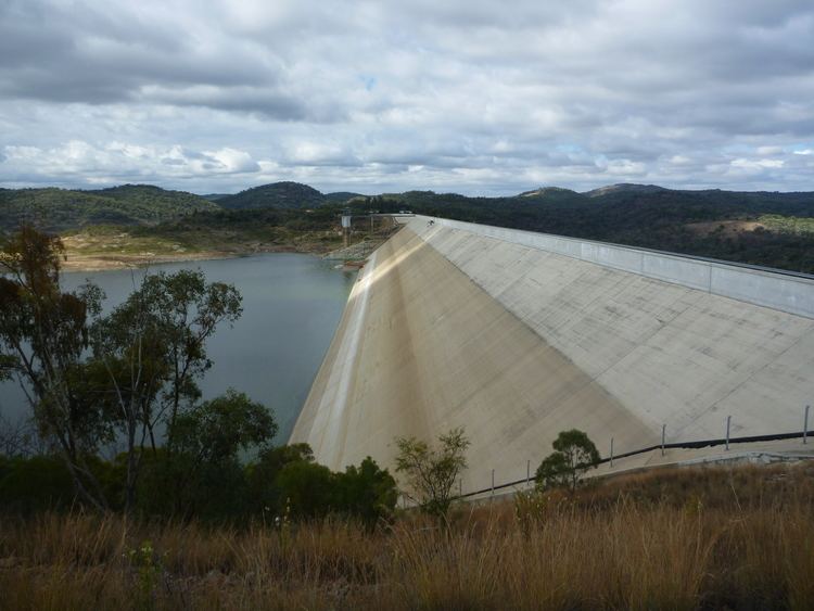
Pindari Dam is a minor concrete faced rockfill embankment dam with an ungated uncontrolled rock cut with concrete sill spillway across the Severn River located upstream of the town of Ashford, in the North West Slopes region of New South Wales, Australia. The dam's purpose includes flood mitigation, hydro-power, irrigation, water supply and conservation. The impounded reservoir is called Lake Pindari.
Contents
- Fishing pindari dam for cod and yellas
- Hopping some tn60 s at pindari dam jackalls
- Location and features
- Power generation
- Recreation
- References
Hopping some tn60 s at pindari dam jackalls
Location and features
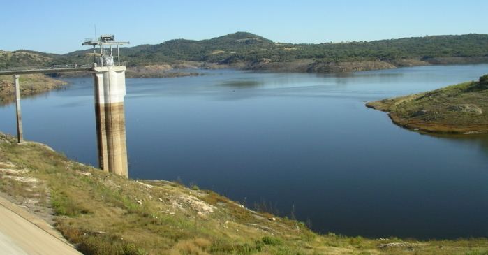
Commenced in 1967 and completed in 1969, the Pindari Dam is a minor dam on the (New South Wales branch of the) Severn River, and is located approximately 58 kilometres (36 mi) north of Inverell, on the upper reaches of the river, within the Border Rivers region. The dam was built by Citra Australia Limited under contract to the New South Wales Water Department of Land and Water Conservation.
The dam wall height is 85 metres (279 ft) and is 954 metres (3,130 ft) long. The maximum water depth is 73 metres (240 ft) and at 100% capacity the dam wall holds back 312,000 megalitres (11,000×10^6 cu ft) of water at 516 metres (1,693 ft) AHD. The surface area of Lake Pindari is 1,050 hectares (2,600 acres) and the catchment area is 2,000 square kilometres (770 sq mi). The ungated uncontrolled rock cut with concrete sill spillway is capable of discharging 20,650 cubic metres per second (729,000 cu ft/s). An upgrade of facilities in 1995 involved doubling the height of the wall from its original 45 metres (148 ft) and increasing capacity to its current levels.
Pindari Dam is operated in conjunction with Queensland's Glenlyon Dam, located on the Dumaresq River, to supply NSW water users in the Border Rivers valley.

The name of the dam originates from the Aboriginal words meaning "high rock" and is the name of an early pastoral run which adjoined the reservoir.
Power generation
Completed in October 2001 at a cost of A$9.2 million, a hydro-electric power station generates up to 5.5 megawatts (7,400 hp) of electricity from the flow of the water leaving Pindari Dam. Constructed by a consortium including Transfield and GE Energy, the facility is owned and operated by Meridian Energy Australia Pty Limited. The hydro project comprises two horizontal Francis turbines rated at 2.8 megawatts (3,800 hp) each and made in Norway, a single generator designed by GE Canada and a transformer manufactured in Australia. The turbine is rated for 68 metres (223 ft) head with a maximum flow of approximately 1,000 megalitres (35×10^6 cu ft) per day. The plant is fully automated and remote controlled. The plant's long-term average energy output has been estimated at 16.3 gigawatt-hours (59 TJ) of green energy per annum, enough to supply approximately 4,000 households.
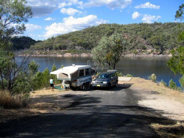
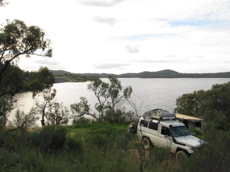
Recreation
Recreation activities on Lake Pindari include bushwalking, picnicking, sailing, swimming, fishing and waterskiing. The foreshore park is a popular local picnic site and camping area on a crown reserve, managed by Inverell Shire Council. There is a lookout on the main dam wall. Recreation facilities include a boat ramp, barbecues, bush shelter sheds and tables and toilets.