
Country India Languages spoken Hindi, Urdu, Punjabi Area 47 km2 | State Region District Pilibhit Founded Hafiz Rahmat Khan Literacy 63.58% | |
Pilibhit (Hindi: )(historic name: Hafizabad) is a city and a municipal board in the Pilibhit district in the Indian state of Uttar Pradesh. Pilibhit is the north-easternmost district of Bareilly division, situated in the Rohilkhand region of the sub-Himalayan Plateau belt next to foothills of Sivalik Range on the boundary of Nepal, known for the origin of river Gomati and one of the most forest-rich areas in North India. According to the Imperial Gazetteer of India, vol. 20, page 144, issued by the Government of India, Pilibhit was once known as Hafizabad, derived from the name of the great Rohella leader of the area Hafiz Rahmat Khan, but eventually it took its present name from a nearby village. Pilibhit was also known as Bansuri Nagari - the land of flutes, for making and exporting roughly 95 per cent of Indias flutes.
Contents
- Map of Pilibhit
- Water supplied to pilibhit
- Geography
- History
- Places of interest
- Economy
- Culture
- Festivals
- References
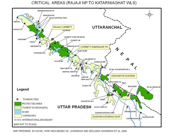
Map of Pilibhit
According to a report issued by the Government of India, Pilibhit is one of the Minority Concentrated Areas in India on the basis of the 2001 census data on population, socio-economic indicators and basic amenities indicators. Though separated only by a short distance from the outer ranges of the Himalayas, Pilibhit consists entirely of a level plain, containing depressions but no hills and is intersected by several streams. Pilibhit is one of the forest rich areas of Uttar Pradesh, which has very high tourism potential. The almost 54 km-long Indo-Nepal international border makes Pilibhit a highly sensitive for security purposes. According an estimate by the Government of India, Pilibhit has 45.23% of its population living under the poverty line. Increasing population and unemployment is a cause of worry in the area, and many non-governmental organisations (NGOs) and government-run organizations have initiated projects to provide employment, but human resources are yet to be exploited in full. The city came third-bottom in terms of hygiene and sanitation in a Government ranking list of 423 towns and cities in India.
Pilibhit has been geographic and political cynosure as it is the only forest area amid the 22 districts and the only district that has an international border in Harit Pradesh, which is proposed to be carved out of Uttar Pradesh.
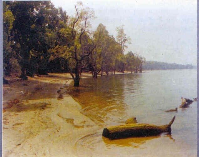
Water supplied to pilibhit
In recent past, Pilibhit has been in news at national level because of a few man killer sub-adult tigers, which has caused fear in the whole area in and around the forest. By August 2010, the cat had killed and partially eaten eight people.
Geography
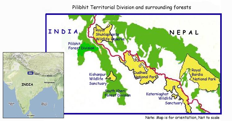
Pilibhit lies between the parallels of 28°64 and 29°53 north latitude and the meridians of 79°57 and 81°37 east longitude covering an area of 68.76 km2. The north side of Pilibhit is bordered by Udham Singh Nagar of Uttarakhand state and by the territory of Nepal. Shahjahanpur lies on the south side Pilibhit. The east of Pilibhit is flanked for a short distance by Lakhimpur Kheri and the remaining distance is swathed by the Shahjahanpur. The western limit touches the limits of Bareilly.
According to the Central Statistical Organisation, the district Pilibhit had an area of 3504 km2 on 1 September 2007, occupying 46th position in the state and the total area of the Pilibhit city is 68.76 km2. Pilibhit city, with 2365.11 people per square kilometer, is more densely populated that the rest of district, which has 469.51 people per km2.
The area has diverse features, and topographically may be divided into several distinct tracts. In the north and north-west, the tract is a continuation of the Terai. The southern portion of the Bisalpur tehsil is similar in most respect to the adjacent tract of Bareilly and Shahjahanpur. The eastern and smaller section approximates rather to undeveloped forest areas of Lakhimpur Kheri, though with the spread of cultivation the dissimilarity between Puranpur and the rest of the area is gradually becoming less marked. There are 1216 villages within Pilibhits limits, of which 982 are electrified.
The area has more than ten small to medium sized rivers and nine small to medium sized water bodies. The origin of river Gomti, Gumti or Gomati (Hindi: ), which is a tributary of the Ganges River, is from a small lake, Gomat Taal, situated in Madhotanda in the Puranpur tehsil region. Another important river in the region is River Sharda (Hindi: ), which runs through on the eastern part of the district. Pilibhit city receives water from the river Devhahuti Ganga or Devha (Hindi: ) on the north-west side of the city and the River Ghaghara or Khakra (Hindi: ) on the north-east side of the city. Pilibhit city also has a few water bodies in its limits, one being on Tanakpur road in front of Dramond college gate, another being at the Chauraha degree college. Every year during winter, the Chauraha water body attracts thousands of migratory birds. The main source of water in the district is the ground water and the canals. District Pilibhit is swathed by a big net of canals. The district has six main feeders or canals, which run through almost 138 km in the district.
The major part of Pilibhit District is covered by dense forest. Total 784.572 km2 is forest. Till 1978, 63% area of the district was a dense forest, but deforestation has reduced the total forest cover to 22.39% in 2004. The Sharda canal is the main canal of the district, the others being its branches. The total length of canals in the district is 138 km. Apart from the canal system, the district also has a few water bodies, which are being using for agriculture purposes.
National Highway No. 74 runs through the district connecting Haridwar to Bareilly via Kichha, Kashipur and Nagina city. Apart from the National Highway, the district is well connected with Shahjahanpur in south, Lakhimpur Kheri and Indian International Border (IIB) with the Nepal in east, Nanital and town Khatima in north, and the city of Bareilly in the west by roads and railways. There are 1216 Villages in the district Pilibhit in four tehsils and seven blocks.
The district Pilibhit also has several places of religious importance in or around the district. A main gurudwara of the Sikh community is located in Nanakmatta town around 46 km from the city.
One of the biggest and the most important temples of the region, Sri Purnagiri Temple, is in the nearby Champawat district of Uttaranchal. Millions of people from around Uttar Pradesh and other parts of Northern India come to this temple, and Pilibhit is one of the halting points for the pilgrims.
History
At the introduction of the British rule, the parganas of Pilibhit, Jahanabad and Bisalpur was formed into separate tehsils. Puranpur was united for this purpose with Khutar. A redistribution of the area was effected in 1824, when the Bisalpur tehsil contained the parganas of Bisalpur and Maurari, which afterward become a single area, Jahanabad was joined with Richha to form tehsil Pareva and Pilibhit with Baheri, the HQ being at Pilibhit. In 1851 Baheri and the other tarai pargana were taken under direct management and in 1863 Richha was attached to the new Baheri tehsil, pargana Jahanabad being assigned to Pilibhit which also received Puranpur on its transfer in 1865. The latter, in 1871, a became subtehsil dependent on Pilibhit. The promotion of Puranpur into a full tehsil occurred in 1879, while Bisalpur throughout remained a separate subdivision. Thus the area is now divided into three tehsils and four parganas. Puranpur and Bisalpur constitute individual tehsils and parganas and the tehsil of Pilibhit comprises the paraganas of Pilibhit and Jahanabad.
Places of interest
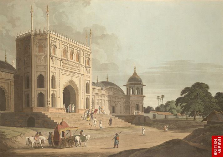
Dargah-e-Shahji Miyan (Hindi: )
In the northern side of the city of Pilibhit a dargha of qutebe Pilibhit Hazrat Kibla Haji Shah Ji Mohammad Sher Mian Sahib Rahmat Ullah Aleh is situated. People travel from other states and countries to take the blessing of Hazrat Shah ji mian. It is also said that by offering a Chadar at the dargah is fruitful to the people. The dargar has become place of social harmony as people of various religions come here to offer their faith.
Economy
The main crop in the district is sugarcane and there is a sugar factory in the city. According to an article published in Hindustan Times, by a 1991 estimate, 95% of Indias flutes were manufectured in Pilibhit. The craftmen were used to source its bamboo from Barak Valley in Assam. Earlier, there was an unbroken narrow-gauge line running from Silchar, in Assam, via Bihar, and into Pilibhit. On this line, 60-strong bundles of bamboo, each stalk 10 ft long, used to make their way to Pilibhit, but around 15 years ago, sections of that line were removed. Now, the bamboo has to travel on narrow gauge from Silchar to Jiribum, then shift onto a broad-gauge line to travel to Bareilly, the nearest big town, and then reloaded onto narrow gauge to come into Pilibhit.
Culture
Festivals
Religious practices are as much an integral part of everyday life and a very public affair as they are in the rest of India. Therefore not surprisingly, many festivals are religious in origin although several of them are celebrated irrespective of caste and creed. Among the most important Hindu festivals are Diwali, Holi and Vijayadashami, Mahashivaratri, Ram Navmi, Basant Panchami, Sri Krishna Janamastmi and Raksha Bandhan,which are also observed by Jains and Sikhs. Eid al-Milad, Eid ul-Fitr, Bakr-Id and Moharram are Muslim religious festivals. Mahavir Jayanti is celebrated by Jains, Buddha Jayanti by Buddhists, Guru Nanak Jayanti by Sikhs and Good Friday, Christmas by the Christians.