
Isolation 1.49 mi (2.40 km) Prominence 345 m | Elevation 4,259 m | |
 | ||
Easiest route Northwest slope: scramble, class 3 Similar Turret Peak, Gladstone Peak, Vestal Peak, Clinton Peak, Casco Peak | ||
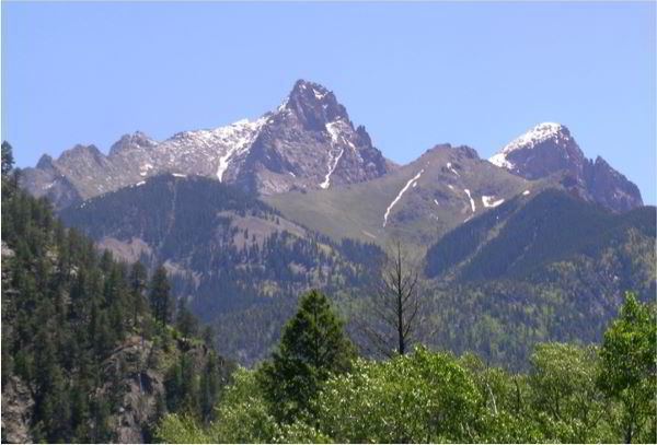
Pigeon Peak, elevation 13,978 ft (4,260 m), is a summit in the Needle Mountains, a subrange of the San Juan Mountains in the southwestern part of the US State of Colorado. It rises dramatically on the east side of the Animas River, 1.5 miles (2.4 km) west of the fourteener Mount Eolus. It is located in the Weminuche Wilderness, part of the San Juan National Forest.
Contents
Map of Pigeon Peak, Colorado 81122, USA
Pigeon Peak is notable both for its absolute height and for its local relief. It is the 57th highest independent peak in Colorado, narrowly missing the well-known list of fourteeners. In terms of local relief, it is one of the most impressive peaks in Colorado. Its most dramatic rise is over the Animas River to the west, over which it rises nearly 6,000 feet (1,829 m) in under 2.5 miles (4 km). Also, its east face is a 800 feet (244 m) cliff.
ClimbingEdit
Since Pigeon Peak is not a fourteener, it sees far less traffic than the nearby trio of Mount Eolus, Windom Peak and Sunlight Peak. The standard route is not technically difficult, but it is long and requires a little-hiked wilderness approach. Climbers typically camp near Ruby Lake north of the peak. From there the route ascends to a saddle between Pigeon Peak and Turret Peak, southwest of Pigeon. The route then descends and makes a traverse around to the opposite side of the peak, finally ascending the northwest slopes. Difficulties involve class 3 scrambling.