
Country Thailand Tambon 15 Postal code 10130 Province Samut Prakan Province Geocode 1104 | Seat Talat Time zone ICT (UTC+7) Area 73.37 km² Population 198,849 (2015) | |
 | ||
Points of interest Bhumibol Bridge, Sri Nakhon Khuean Khan Par, Lat Pho Park, Wat Songtham Worawihan, Bangkajao Destinations Bang Kachao, Kanchanaphisek Road, Bang Ya Praek | ||
Samut prakan pier ferry to phra pradaeng across the chao phraya river thailand
Phra Pradaeng (Thai: พระประแดง; [pʰráʔ prā.dɛ̄ːŋ]) is a district (amphoe) of Samut Prakan Province in Thailand.
Contents
- Samut prakan pier ferry to phra pradaeng across the chao phraya river thailand
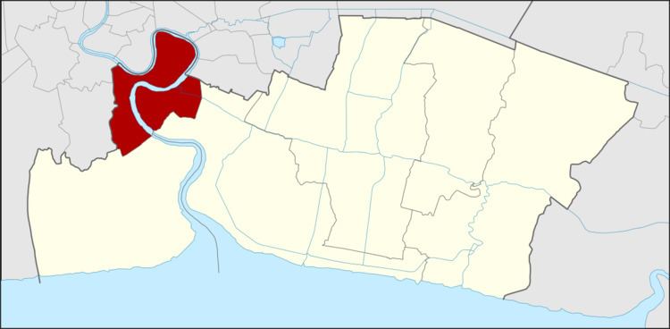
- Map of Phra Pradaeng District Samut Prakan Thailand
- Geography
- History
- Administration
- References
Map of Phra Pradaeng District, Samut Prakan, Thailand
Geography
Neighboring districts are (from the west clockwise) Thung Khru, Rat Burana, Yan Nawa, Khlong Toei, Phra Khanong and Bang Na (all Bangkok), and the districts Mueang Samut Prakan, and Phra Samut Chedi of Samut Prakan. The district is on a bend of the Chao Phraya River.
History
Phra Pradeang was the original center of the area south of Bangkok near the mouth of the Chao Phraya River. Originally named "Nakhon Khuan Khan" (นครเขื่อนขันธ์), it was settled by Mon people. In 1815, King Rama II built the Pom Phlaeng Faifa Fort at the river's bend. The fort is now a small park and is accessible to visitors.
In 1819, the new town Samut Prakan (or Paknam) was established. Due to economic problems in the early-1930s, several administrative entities were abolished, including Phra Phradaeng Province, which had its districts assigned to Samut Prakan and Thonburi effective 1 April 1932.
A two kilometre tramway across the neck of the Phra Pradaeng river bend opened in 1908 and closed c. 1940. Operated by a private company, the motorised trams connected with motorboat services to Bangkok and to Paknam at each end of the line. The tram cut a considerable time off the up and downriver journey by avoiding the long river bend.
Administration
The district is divided into 15 sub-districts (tambon), which are further subdivided into 67 villages (muban). The town (thesaban mueang) Phra Pradaeng covers the tambon Talad, the town Lat Luang, the tambon Bang Phueng, Bang Chak, and Bang Kharu. The township (thesaban tambon) Samrong Thai covers the tambon Samrong Tai, Samrong, Samron Klang, Bang Hua Suea, and Bang Ya Phraek. There are six tambon administrative organizations (TAO) for the tambon not covered by the municipalities.