
Prominence 2,079 m | Elevation 2,819 m Mountain range Annamite Range | |
 | ||
Listing Country high pointUltra Similar Phu Xai Lai Leng, Hkakabo Razi, Phou Khe, Bukit Pagon, Phnom Aural | ||
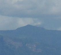
Phou Bia (Lao: ພູເບັ້ຍ) is the highest mountain in Laos and is located in the Annamese Cordillera, at the southern limit of the Xiangkhoang Plateau in Xiangkhouang Province. Owing to its altitude, the climate is cold and the area around the mountain is mostly cloudy.
Contents
Map of Phou Bia, Laos
HistoryEdit
Although no snow has been reported for decades, it is documented that as late as the first years of the 20th century, snow fell occasionally on its top.
On 10 April 1970, an Air America C-130A aircraft crashed into the mountain.
The area is remote, covered with jungle, and has been used by Hmong guerilla soldiers. In the 1970s, ca 60,000 Hmong supporting FAC operations took refuge at the Phou Bia massif. There have been reports of smaller Hmong hideouts in the area as recently as 2006.
Phou Bia rises in a restricted military area near the abandoned Long Chen air base, and for this reason sees extremely few outside visitors. Unexploded ordnance further complicates access. As of July 2008, there had been no known ascent by a non-Lao person for at least 30 years.