
Largest city Helena-West Helena Area 1,884 km² County seat Helena-West Helena | Founded 1 May 1820 Population 20,399 (2013) | |
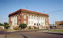 | ||
Website phillipscounty.arkansas.gov University Phillips Community College of the University of Arkansas Points of interest Delta Cultural Center, New Fort Curtis, Jerome Bonaparte Pillow Ho, Helena Museum of Phillips C, Helena Bridge | ||
Phillips County is a county located in the eastern part of the U.S. state of Arkansas, in what is known as the Arkansas Delta along the Mississippi River. As of the 2010 census, the population was 21,757. The county seat is Helena-West Helena. Phillips County is Arkansas's seventh county, formed on May 1, 1820, and named for Sylvanus Phillips, the area's first-known white settler and representative to the first Territorial Legislature of the Arkansas Territory. This lowland area was developed for cotton plantations in the antebellum area and is still largely rural.
Contents
- Map of Phillips County AR USA
- Geography
- Major highways
- Adjacent counties
- National protected areas
- Demographics
- Education
- Cities
- Town
- Unincorporated places
- Townships
- Notable people
- References
Map of Phillips County, AR, USA
The Helena-West Helena, AR Micropolitan Statistical Area includes all of Phillips County.
In 1919 during the Elaine race riot in Phillips County, 237 African Americans were killed, attacked by armed whites trying to suppress the Progressive Farmers and Household Union of America which was organizing in the county. Because of the white mob action, the deaths were classified as lynchings by the Equal Justice Institute in its 2015 report. Phillips County thus ranks as the county with the highest number of lynchings in U.S. history.
Geography
According to the U.S. Census Bureau, the county has a total area of 727 square miles (1,880 km2), of which 696 square miles (1,800 km2) is land and 32 square miles (83 km2) (4.4%) is water.
Major highways
Adjacent counties
National protected areas
Demographics
As of the 2010 United States Census, there were 21,757 people residing in the county. 63.1% were Black or African American, 35.0% White, 0.3% Asian, 0.2% Native American, 0.4% of some other race and 0.9% of two or more races. 1.3% were Hispanic or Latino (of any race).
As of the 2000 United States Census, there were 26,445 people, 9,711 households, and 6,768 families residing in the county. The population density was 38 people per square mile (15/km²). There were 10,859 housing units at an average density of 16 per square mile (6/km²). The racial makeup of the county was 59.04% Black or African American, 39.25% White, 0.43% from other races, 0.32% Asian, 0.17% Native American, 0.01% Pacific Islander, and 0.78% from two or more races. 1.44% of the population were Hispanic or Latino of any race.
There were 9,711 households out of which 34.20% had children under the age of 18 living with them, 40.30% were married couples living together, 25.10% had a female householder with no husband present, and 30.30% were non-families. 27.60% of all households were made up of individuals and 13.00% had someone living alone who was 65 years of age or older. The average household size was 2.69 and the average family size was 3.29.
In the county, the population was spread out with 32.20% under the age of 18, 9.40% from 18 to 24, 23.20% from 25 to 44, 21.20% from 45 to 64, and 13.90% who were 65 years of age or older. The median age was 33 years. For every 100 females there were 84.70 males. For every 100 females age 18 and over, there were 77.70 males.
The median income for a household in the county was $22,231, and the median income for a family was $26,570. Males had a median income of $24,675 versus $17,520 for females. The per capita income for the county was $12,288. About 28.70% of families and 32.70% of the population were below the poverty line, including 45.50% of those under age 18 and 26.20% of those age 65 or over.
For the period 2000-2009, the Helena-West Helena statistical area lost 20.89% of its population, the largest decline of any statistical area in the country.
Education
School districts serving Phillips County include the Helena-West Helena School District, the Marvell–Elaine School District, and the Barton–Lexa School District.
Previously the Lake View School District served a portion of the county. On July 1, 2004, the Lake View district merged into the Barton–Lexa district. Previously the Elaine School District served another portion of the county. On July 1, 2006, the Elaine district merged into the Marvell district.
Marvell Academy, a private school founded in 1966 as a segregation academy., is in unincorporated Phillips County, near Marvell.
Cities
Town
Unincorporated places
Townships
Townships in Arkansas are the divisions of a county. Each township includes unincorporated areas; some may have incorporated cities or towns within part of their boundaries. Arkansas townships have limited purposes in modern times. However, the United States Census does list Arkansas population based on townships (sometimes referred to as "county subdivisions" or "minor civil divisions"). Townships are also of value for historical purposes in terms of genealogical research. Each town or city is within one or more townships in an Arkansas county based on census maps and publications. The townships of Phillips County are listed below; listed in parentheses are the cities, towns, and/or census-designated places that are fully or partially inside the township.