
1819–1836 → → 1835–1836 William Savin Fulton | Date dissolved June 15, 1836 | |
 | ||
Government Organized incorporated territory Capitals Arkansas Post National Memorial (1819–1821), Little Rock (1821–1836) | ||
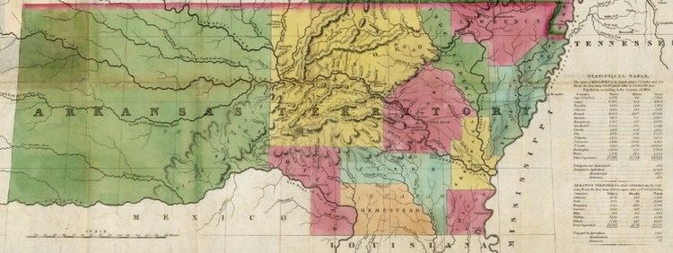
The Territory of Arkansas, initially organized as the Territory of Arkansaw, was an organized incorporated territory of the United States that existed from March 2, 1819 until June 15, 1836, when the final extent of the territory was admitted to the Union as the State of Arkansas.
History
Arkansaw Territory (later Arkansas Territory) was created from the portion of the Missouri Territory lying south of a point on the Mississippi River at 36 degrees north latitude running west to the St. Francois River, then followed the river to 36 degrees 30 minutes north latitude, then west to the territorial boundary. This included all of the present state of Oklahoma south of the parallel 36°30' north. The westernmost portion of the territory was removed on November 15, 1824, a second westernmost portion was removed on May 6, 1828, reducing the territory to the extent of the present state of Arkansas.
Originally the western border of Missouri was intended to go due south to the Red River. During negotiations with the Choctaw in 1820, however, Andrew Jackson unknowingly ceded more of Arkansas territory. Then in 1824, after further negotiations, the Choctaw agreed to move farther west, but only by "100 paces" of the garrison on Belle Point. This resulted in the bend in the common border at Fort Smith, Arkansas.
Until Oklahoma received statehood, Fort Smith served as the ostensible legal authority overseeing the Oklahoma Territory. The Army oversaw issues dealing with the Indian Nations.
Arkansas Post was the first territorial capital (1819–1821) and Little Rock was the second (1821–1836).