
Prominence 75 metres (246 ft) Elevation 1,064 m | Mountain range Alps | |
 | ||
Similar Säntis, Karren, Gebhardsberg, Hochgrat, Diedamskopf | ||
The Pfänder is a mountain in western Austria close to Lake Constance (Bodensee). The town of Bregenz lies at the foot of the mountain on the shores of the lake. With its views over the lake and the surrounding mountain peaks, the Pfänder is one of the most famous lookout points of the region.
Contents
Map of Pf%C3%A4nder, 6911 Lochau, Austria
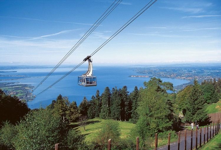
With good visibility, the view from the summit reaches from the Allgäu and Lech valley Alps in the east, over to the Bregenz Forest, the steep mountain peaks of Arlberg region, Silvretta, and the Rätikon to the Swiss mountains and the foothills of the Black Forest in the west. Below is Lake Constance, surrounded by the Rhine valley and the Swabian hills.
The mountain is a popular tourist destination, with hiking paths, an alpine park, a birds of prey show and a restaurant.
TransportEdit
The Pfänder Tunnel takes the A14 motorway underneath the Pfänder, bypassing Bregenz. This is a now a dual tunnel, having opened in July 2013
The summit of the Pfänder can be reached by a cable car called the Pfänderbahn, with the base station in the town of Bregenz. The cable car covers a height difference of over 600m in around 6 minutes.