
Vehicle registration TN-99 Population 7,937 (2001) | Time zone IST (UTC+5:30) Elevation 418 m Local time Tuesday 12:35 AM | |
 | ||
Weather 26°C, Wind S at 3 km/h, 76% Humidity | ||
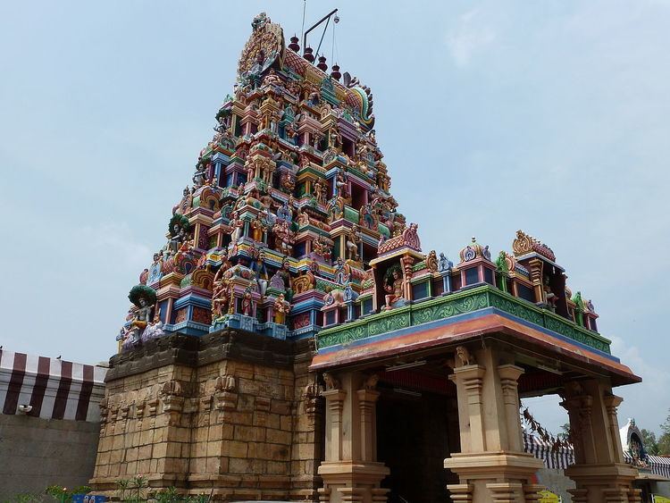
Perur pateeswarar temple in coimbatore
Perur is a neighbourhood located on western side of Coimbatore in the Indian state of Tamil Nadu.It has famous Siva Temple, Patteeswarar.
Contents
- Perur pateeswarar temple in coimbatore
- Map of Perur Coimbatore Tamil Nadu 641010
- Documentary film perur pateeswarar temple
- Geography
- Etymology
- Demographics
- Politics
- Religious importance
- References
Map of Perur, Coimbatore, Tamil Nadu 641010
Documentary film perur pateeswarar temple
Geography
Perur is situated about 7 km from Coimbatore City Railway station and 25 km from Coimbatore Airport. The area is mostly agricultural. Predominantly Cash crops like coconut, banana are grown in Perur .
Etymology
According to the Tamil Nadu, Senthandivakaram any place which has more than 500 families will be considered as Perur. So in ancient times this must be a fertile land and populated area.
Demographics
As of 2001 India census, Perur had a population of 7937. Males constitute 50% of the population and females 50%. Perur has an average literacy rate of 69%, higher than the national average of 59.5%: male literacy is 76%, and female literacy is 61%. In Perur, 10% of the population is under 6 years of age.
Politics
Perur assembly constituency is part of Coimbatore (Lok Sabha constituency).
Religious importance
Perur is very famous for its very old Perur Pateeswarar Temple. The temple was built by Karikala cholan. Other than this temple there are numerous other temples and many wedding halls. Just 500 m away from the main temple is the bank of Noyyal river. People arrive here round the year to perform the rituals of deceased people