
 | ||
Geological history of the perth basin
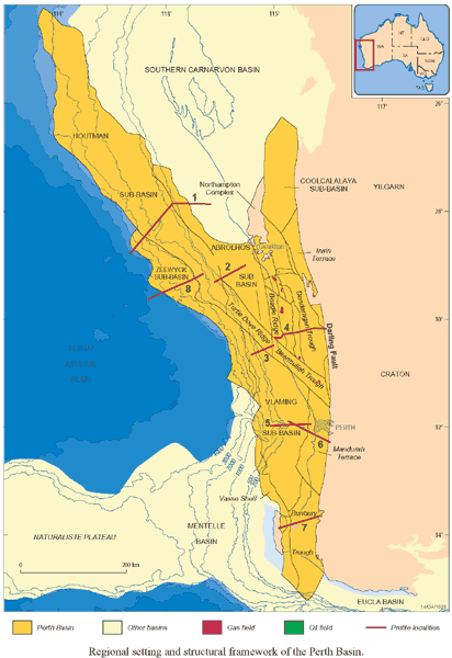
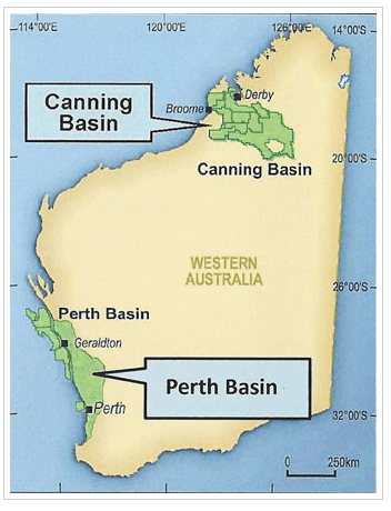
The Perth Basin is a thick, elongated sedimentary basin in Western Australia. It lies beneath the Swan Coastal Plain west of the Darling Scarp, representing the western limit of the much older Yilgarn Craton, and extends further west offshore. Cities and towns including Perth, Busselton, Bunbury, Mandurah and Geraldton are built over the Perth Basin.
Contents
- Geological history of the perth basin
- Potash west developing potassium rich glauconite deposits in western australia s perth basin
- Geological setting and evolution
- Stratigraphy
- Quaternary and Recent
- Cretaceous
- Jurassic
- Triassic
- Economic geology
- Regions
- References
Potash west developing potassium rich glauconite deposits in western australia s perth basin
Geological setting and evolution
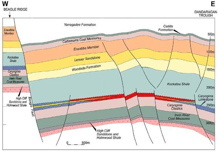
The Perth Basin began forming in the Late Permian during the breakup of Gondwana, as the Australian continental plate began rifting away from the African and Indian continental plates.
During the Permian, what is now the Perth Basin was the eastern half of a rift valley that formed as the continental plates were pulled apart. This pulling apart, which continued until the Jurassic, led to the central zone subsiding as a graben allowing the sea to enter with the subsequent deposition of transgressive marine sediments. The Perth Basin architecture is dominated by listric, extensional faulting that formed during sedimentation and controlled the distribution of the sediments.
The primary mechanism for sedimentation was originally subsidence creating accommodation (space for sediments to accumulate), followed by fault extension and more recently, sediment loading, i.e. the basin continuing to subside because of the weight of sediments within it.
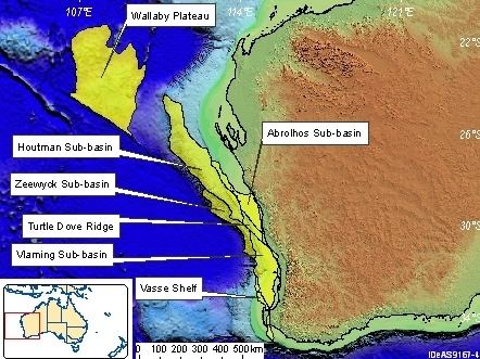
The eastern boundary of the main Perth Basin is the Darling Fault, topographically expressed as the Darling Scarp. Small outliers of the Perth Basin, such as the Collie Sub-basin, lie east of the Darling Fault.
Stratigraphy
Letters in brackets after the formation name represent shorthand symbols used on geological maps.
Quaternary and Recent
The Quaternary and Recent sedimentation of the Perth Basin is represented by thin, impermanent sand dune systems, biogenic limestones, sandstones and some shales deposited during the last ~20 million years and during ice ages.
Cretaceous
Upper Cretaceous glauconitic marl, infrequently developed on top of the Coolyena Group.
Jurassic
Triassic
Economic geology
Cainozoic sand dune systems are locally being mined for mineral sands, mainly rutile (a source of titanium ) and zircon, by Iluka Resources and other companies. Some of these mines are controversial for environmental reasons.
Various formations from Cainozoic to Jurassic age are economically significant freshwater aquifers. Younger aquifers are an important suppliant to reservoir water in the city of Perth and elsewhere. The Yarragadee Formation, one of the thickest formations in the basin, is a very good aquifer in the southern part of the basin.
The Perth Basin contains Permian and Jurassic coal measures, the most important being mined primarily for electricity generation in the Collie Sub-basin at Collie in the south-west of the state.
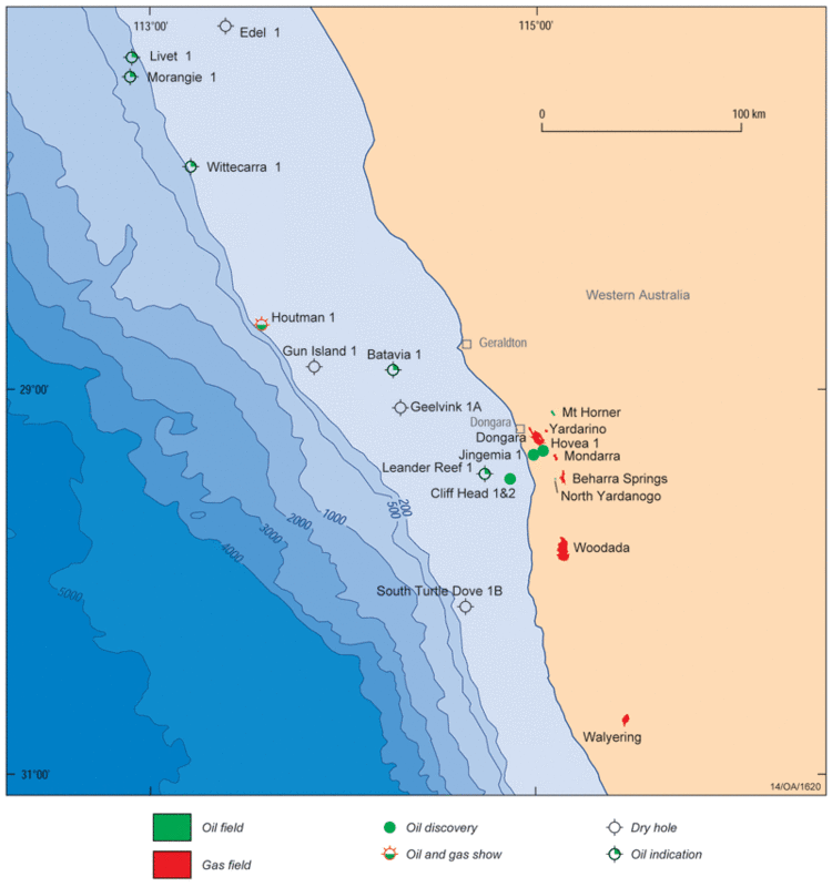
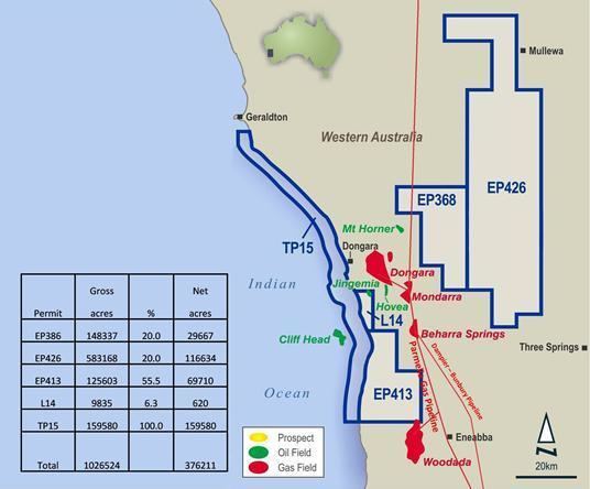
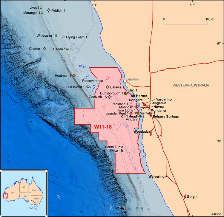
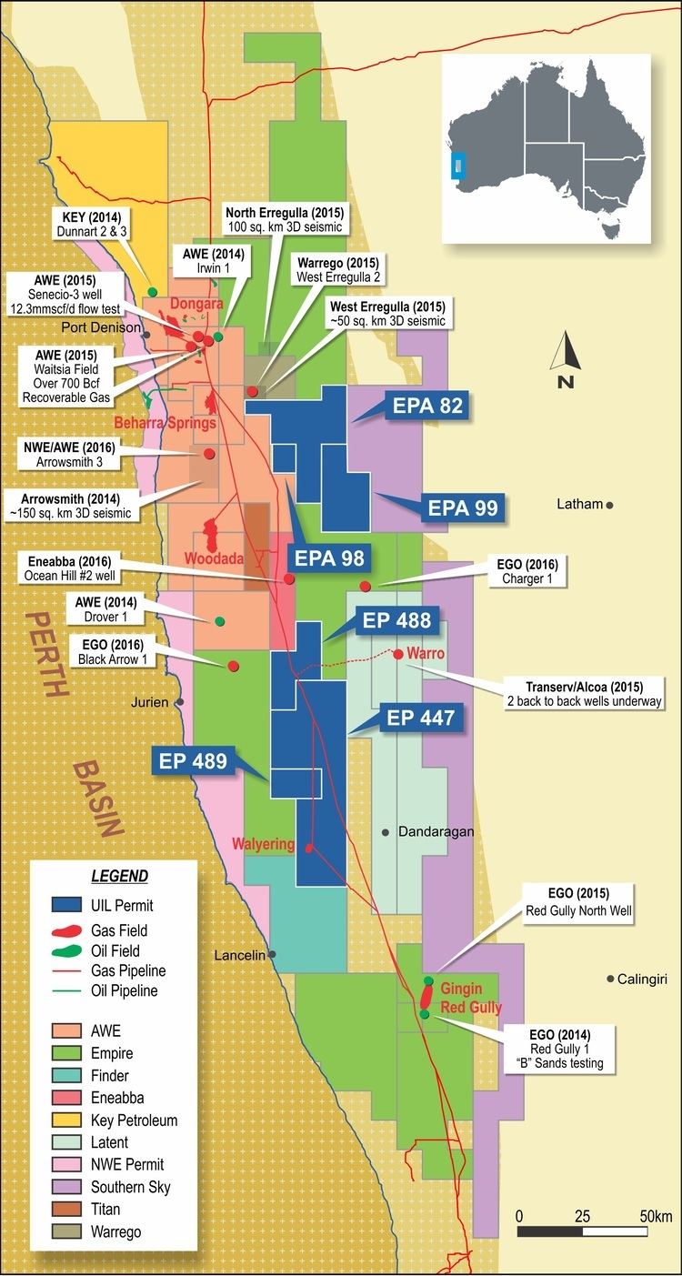
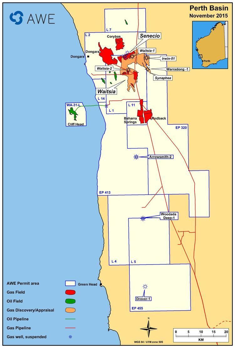
The Perth Basin is also prospective for natural gas and oil, with recent exploration wells, including Origin Energy/Arc Energy's Hovea 2, confirming large resources of natural gas, but difficult reservoir geology and characteristics have prevented the full utilisation of these energy reserves. The oil is sourced from the Kockatea Shale.
Currently, a junior minerals exploration company is exploring the basin north of Perth for glauconite to produce potash fertilizer.
Regions
Due to its shape and size, the basin has been surveyed and studied in distinctions such as offshore and onshore, north south, and central