Type Major Movement north-east | Approximate area 11,900,000 km Speed 26-36mm/year | |
 | ||
Features | ||
Indian plate
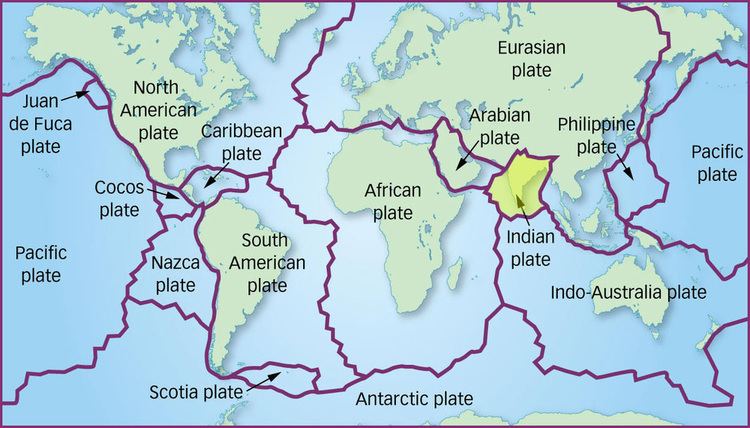
The Indian Plate or India Plate is a major tectonic plate straddling the equator in the eastern hemisphere. Originally a part of the ancient continent of Gondwana, India broke away from the other fragments of Gondwana 100 million years ago and began moving north. Once fused with the adjacent Australia to form a single Indo-Australian Plate, recent studies suggest that India and Australia have been separate plates for at least 3 million years and likely longer. The Indian plate includes most of South Asia—i.e. the Indian subcontinent—and a portion of the basin under the Indian Ocean, including parts of South China and Eastern Indonesia, and extending up to but not including Ladakh, Kohistan and Balochistan.
Contents
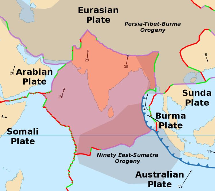
Plate movements
Until roughly 140 million years ago, the Indian Plate formed part of the supercontinent Gondwana together with modern Africa, Australia, Antarctica, and South America. Gondwana broke up as these continents drifted apart at different velocities, a process which led to the opening of the Indian Ocean.
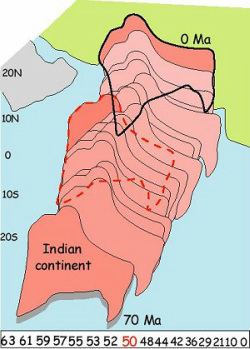
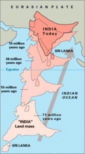
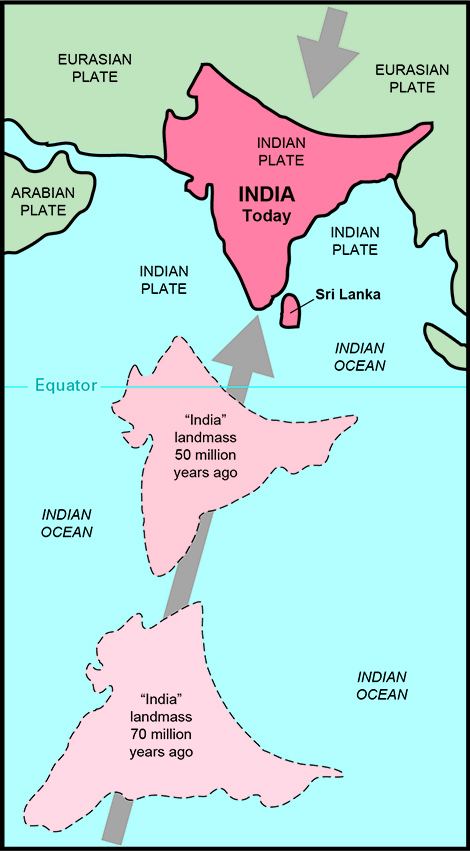
In the late Cretaceous, approximately 100 million years ago and subsequent to the splitting off from Gondwana of conjoined Madagascar and India, the Indian Plate split from Madagascar. It began moving north, at about 20 centimetres (7.9 in) per year, and is believed to have begun colliding with Asia as early as 55 million years ago, in the Eocene epoch of the Cenozoic. However, some authors suggest that the collision between India and Eurasia occurred much later, around 35 million years ago. If the collision occurred between 55 and 50 Mya, the Indian Plate would have covered a distance of 3,000 to 2,000 kilometres (1,900 to 1,200 mi), moving faster than any other known plate. In 2012, paleomagnetic data from the Greater Himalaya was used to propose two collisions to reconcile the discrepancy between the amount of crustal shortening in the Himalaya (~1300 km) and the amount of convergence between India and Asia (~3600 km). These authors propose a continental fragment of northern Gondwana rifted from India, traveled northward, and initiated the "soft collision" between the Greater Himalaya and Asia at ~50 Ma. This was followed by the "hard collision" between India and Asia occurred at ~25 Ma. Subduction of the resulting ocean basin that formed between the Greater Himalayan fragment and India explains the apparent discrepancy between the crustal shortening estimates in the Himalaya and paleomagnetic data from India and Asia.
In 2007, German geologists suggested that the reason the Indian Plate moved so quickly is that it is only half as thick (100 kilometres or 62 miles) as the other plates which formerly constituted Gondwana. The mantle plume that once broke up Gondwana might also have melted the lower part of the Indian subcontinent, which allowed it to move both faster and further than the other parts. The remains of this plume today form the Marion Hotspot (Prince Edward Islands), the Kerguelen hotspot, and the Réunion hotspots. As India moved north, it is possible that the thickness of the Indian plate degenerated further as it passed over the hotspots and magmatic extrusions associated with the Deccan and Rajmahal Traps. The massive amounts of volcanic gases released during the passage of the Indian Plate over the hotspots have been theorised to have played a role in the Cretaceous–Paleogene extinction event, generally held to be due to a large asteroid impact.
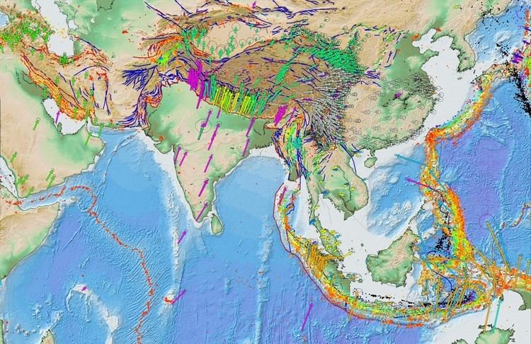
The collision with the Eurasian Plate along the boundary between India and Nepal formed the orogenic belt that created the Tibetan Plateau and the Himalaya Mountains, as sediment bunched up like earth before a plow.
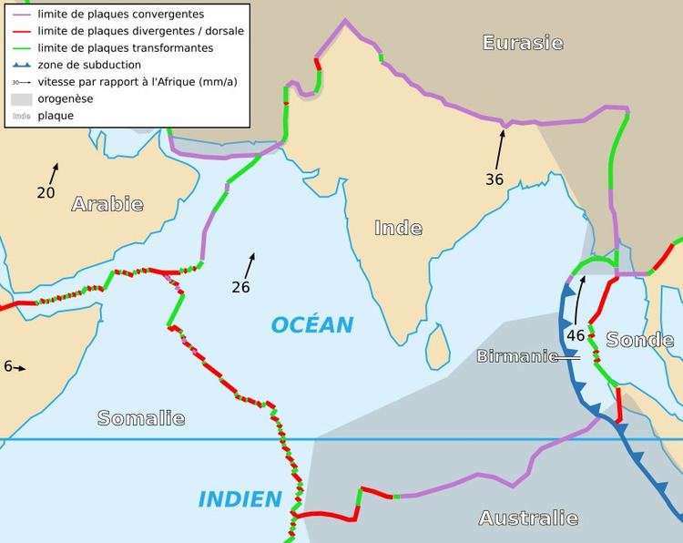
The Indian Plate is currently moving north-east at 5 centimetres (2.0 in) per year, while the Eurasian Plate is moving north at only 2 centimetres (0.79 in) per year. This is causing the Eurasian Plate to deform, and the Indian Plate to compress at a rate of 4 millimetres (0.16 in) per year.
Geography
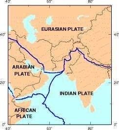
The westerly side of the Indian Plate is a transform boundary with the Arabian Plate called the Owen Fracture Zone, and a divergent boundary with the African Plate called the Central Indian Ridge (CIR). The northerly side of the Plate is a convergent boundary with the Eurasian Plate forming the Himalaya and Hindu Kush mountains.