
Climate Csa Area 865 km² | Post code 62500 Website www.pertek.bel.tr Local time Monday 8:33 PM | |
 | ||
Weather 11°C, Wind SW at 14 km/h, 46% Humidity | ||
Dersim in parlayan y ld z pertek
Pertek (Armenian: Բերդակ), (Kurdish: Pêrtag) is a small city and its surrounding district in Tunceli Province of modern Turkey. Pertag, means "tiny fortress" in Armenian.
Contents
- Dersim in parlayan y ld z pertek
- Map of Pertek 62500 Pertek2FTunceli Turkey
- Osman bulut pertek
- References
Map of Pertek, 62500 Pertek%2FTunceli, Turkey
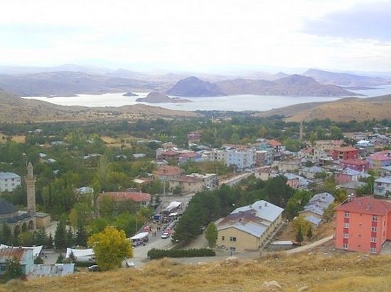
The area of Pertek was ruled by different empires in its history. In the medieval period such as the Armenians and Byzantines before being taken over by different Islamic dynasties after the 11th century. Later it became part of the Ilkhanids and others and finally became part of the Ottoman Empire in the early 16th century. During the Ottoman period Pertek was a hereditary Kurdish sanjak. The old town of Pertek was located near the citadel but was abandoned in 1838 and moved to its current location. Before the Armenian genocide it was populated by Armenians, Turks and Kurds. Today the city is populated by Turks and Kurds. The mayor is Recai Vural (AKP). The city has a population of 6,341.
There are two historic Ottoman mosques in Pertek.The Baysungur mosque (16th century) and Celebi Ali mosque (16th century). The mosques were later dismantled and moved from the site of the old town to protect them from flooding in Lake Keban. Nearby Pertek is a medieval castle. There are other historic sights in the nearby area. The village of Sağman has a ruined citadel with a 16th-century mosque, tomb and tekke built by the Kurdish sanjak bey Keykusrav.