
Country United States GNIS feature ID 453719 Local time Monday 9:13 AM | FIPS code 18-59022 Elevation 314 m Population 1,511 (2010) | |
 | ||
Weather 12°C, Wind S at 6 km/h, 87% Humidity Area 78.11 km² (73.17 km² Land / 4.973 km² Water) | ||
Perry Township is one of twelve townships in Delaware County, Indiana. According to the 2010 census, its population was 1,511 and it contained 648 housing units.
Contents
- Map of Perry Township IN USA
- History
- Geography
- Unincorporated towns
- Adjacent townships
- Cemeteries
- References
Map of Perry Township, IN, USA
History
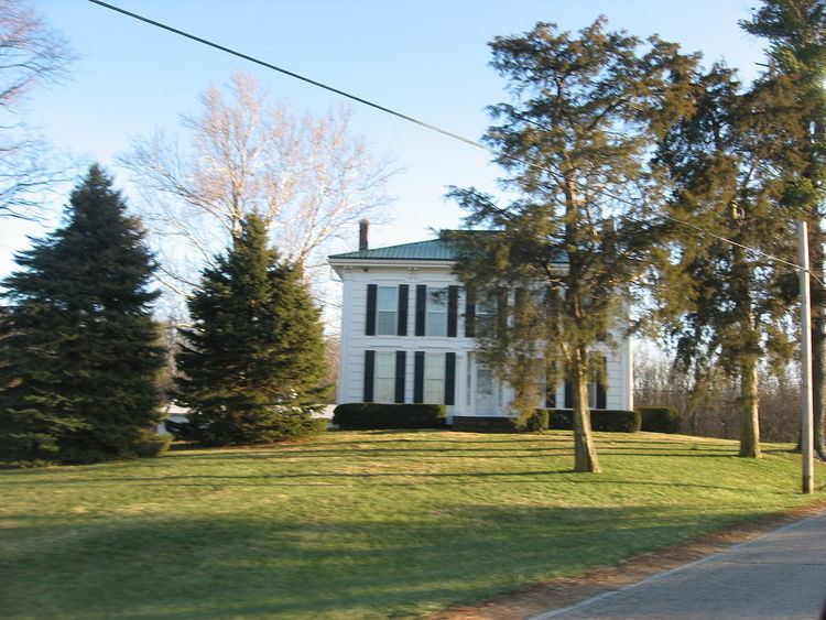
The Dr. Samuel Vaughn Jump House was listed on the National Register of Historic Places in 1982.
Geography
According to the 2010 census, the township has a total area of 30.16 square miles (78.1 km2), of which 28.25 square miles (73.2 km2) (or 93.67%) is land and 1.92 square miles (5.0 km2) (or 6.37%) is water.
Unincorporated towns
(This list is based on USGS data and may include former settlements.)
Adjacent townships
Cemeteries
The township contains two cemeteries: Felton and Mount Pleasant.
References
Perry Township, Delaware County, Indiana Wikipedia(Text) CC BY-SA