
Airport type Public Elevation AMSL 418 ft / 127 m 5,002 1,525 Phone +1 478-988-3699 | 18/36 5,002 Elevation 127 m | |
 | ||
Address 200 Myrtle Field Rd, Perry, GA 31069, USA | ||
Perry–Houston County Airport (ICAO: KPXE, FAA LID: PXE) is a public airport located four miles (6 km) northwest of the central business district of Perry, a city in Houston County, Georgia, United States and 10 miles (16 km) south of Warner Robins, Georgia. It is owned by the Perry–Houston County Airport Authority. It is used for general aviation, mainly flight training.
Contents
Overview
Although most U.S. airports use the same three-letter location identifier for the FAA and IATA, Perry–Houston County Airport is assigned PXE by the FAA but has no designation from the IATA.
Facilities and aircraft
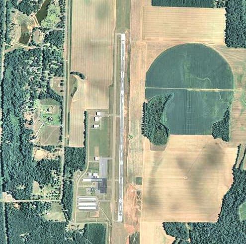
Perry–Houston County Airport covers an area of 465 acres (188 ha) and contains one asphalt paved runway designated 18/36 which measures 5,002 x 100 ft (1,525 x 30 m). For the 12-month period ending January 31, 2006, the airport had 22,000 general aviation aircraft operations, an average of 60 per day. There are 67 aircraft based at this airport: 91% single-engine, 6% multi-engine and 3% helicopter.
History
Opened in July 1942, during World War II, the airport was used as an auxiliary training airfield for the Army pilot school at Cochran Army Airfield. With the end of the war, it was turned over to the city of Perry and developed into a municipal airport which opened in May 1947