
Time zone CET (UTC+1) Area 30.3 km² Dialling code 0474 | Dialing code 0474 Local time Monday 3:47 AM Postal code 39030 | |
 | ||
Frazioni Aschbach, Wielenberg (Sopranessano), Nasen (Nessano), Litschbach (Rio Liccio), Platten (Plata Montevila), Oberwielenbach (Vila di Sopra), Unterwielenbach (Vila di Sotto) Weather 3°C, Wind SE at 3 km/h, 84% Humidity Region Trentino-Alto Adige/South Tyrol | ||
Video 11 obturation with warmed gutta percha
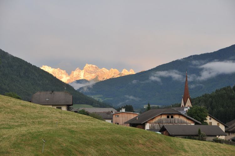
Percha ( [ˈpɛrça]; Italian: Perca [ˈpɛrka]) is a comune (municipality) in South Tyrol in northern Italy, located about 60 kilometres (37 mi) northeast of Bolzano. This Percha is not to be confused with Percha of the Federal Republic of Germany.
Contents
- Video 11 obturation with warmed gutta percha
- Map of 39030 Perca Province of Bolzano South Tyrol Italy
- Percha nunca digas que no
- Geography
- Frazioni
- Coat of arms
- Linguistic distribution
- References
Map of 39030 Perca Province of Bolzano - South Tyrol, Italy
Percha nunca digas que no
Geography
As of 30 November 2010, it had a population of 1,449 and an area of 30.3 square kilometres (11.7 sq mi).
Percha borders the following municipalities: Bruneck, Sand in Taufers, Gais and Rasen-Antholz.
Frazioni
The municipality of Percha contains the frazioni (subdivisions, mainly villages and hamlets) Aschbach, Wielenberg (Sopranessano), Nasen (Nessano), Litschbach (Rio Liccio), Platten (Plata Montevila), Oberwielenbach (Vila di Sopra), and Unterwielenbach (Vila di Sotto).
Coat-of-arms
The shield is party per fess of argent and gules; a deer horn with six points is represented in the upper part, a sable plow in the lower. The deer horn symbolizes the hunting and the woods, the six points are the six villages in the municipality; the plow represents the agriculture practiced in the territory. The coat of arms was granted in 1967.
Linguistic distribution
According to the 2011 census, 94.86% of the population speak German, 4.29% Italian and 0.84% Ladin as first language.