Time zone IST (UTC+5:30) Population 3,534 (2011) | Mandal Tenali Area 5.53 km² | |
 | ||
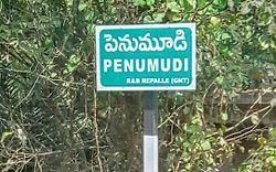
Penumudi is a village in Guntur district of the Indian state of Andhra Pradesh. It is located in Repalle mandal of Tenali revenue division. It is lcoated on the banks of Krishna river.
Contents
- Map of Penumudi Andhra Pradesh 522265
- Geography
- Demographics
- Government and politics
- Economy
- Transport
- References
Map of Penumudi, Andhra Pradesh 522265
Geography
Kolakaluru is located at 16.3052°N 80.6182°E / 16.3052; 80.6182. The village is spread over an area of 5.53 km2 (2.14 sq mi).
Demographics
As of 2011 census, Penumudi had a population of 3,534 with 1,044 households. The total population constitute, 1,752 males and 1,782 females —a sex ratio of 1017 females per 1000 males. 316 children are in the age group of 0–6 years, of which 170 are boys and 146 are girls. The average literacy rate stands at 63.05% with 2,029 literates, lower than the state average of 67.41%.
Government and politics
Penumudi gram panchayat is the local self-government of the village. The elected members of the gram panchayat is headed by a sarpanch.
Economy
Agriculture and Aquaculture are the main occupations of the villagers. Paddy and black gram and corn are the major crops cultivated. While, prawns are the main source of income in aquaculture.
Transport
National Highway 214A passes through Penumudi. The nearest major railway station to the village is Repalle.
