
Country India Administrative division Guntur district Tehsils 57 Area 11,391 km² Major highway National Highway 63 | Headquarters Guntur City Vehicle registration AP-07 Literacy 68% | |
 | ||
Colleges and Universities Acharya Nagarjuna University Lok sabha constituencies Guntur, Narasaraopet, Bapatla Points of interest Kondaveedu Fort, Nagarjuna Sagar Dam, Undavalli Caves, Suryalanka Beach, Haailand Destinations | ||
Guntur district is an administrative district in the Coastal Andhra region of the Indian state of Andhra Pradesh. The administrative seat of the district is located at Guntur, the largest city of the district in terms of area and population. It has a coastline of approximately 100 km and is situated on the right bank of Krishna River, that separates it from Krishna district and extends till it empties into the Bay of Bengal. It is bounded on the south by Prakasam district and on the west by the state of Telangana. It has an area of 11,391 km2 (4,398 sq mi) and is the 2nd most populous district in the state a population of 4,889,230 as per 2011 census of India.
Contents
- Map of Guntur Andhra Pradesh
- Etymology
- History
- Post Independence
- Geography
- Demographics
- Administrative divisions
- Mandals
- Culture
- Economy
- Transport
- Education and research
- References
Map of Guntur, Andhra Pradesh
The district is a major centre for agriculture, education and learning. It exports large quantities of chillies and tobacco. Amaravati, the proposed capital of Andhra Pradesh is situated in Guntur district, on the banks of River Krishna.
Etymology
There are several opinions on the meaning and origin of the word Guntur. In Sanskrit, Guntur was called Garthapuri.
History
The original Sanskrit name (ancient Vedic culture) for Guntur was Garthapuri. The 'Agasthyeswara Sivalayam' in the old city of Guntur is an ancient temple for Siva. {citation needed}
It has inscriptions on two stones in 'Naga Lipi' (ancient script). It is said that Agastya built the temple in the last Treta-Yuga around the Swayambhu Linga and hence the name. The 'Nagas' were said to have ruled the region. The place of Sitanagaram and the Guthikonda Caves can be traced (through Vedic Puranas) back to the last Treta-Yuga and Dwapara-Yuga (Traditional Time scale: 1.7 to 0.5 million years ago).{citation needed}
Guntur District is home to the second oldest evidence of human habitation in India, in the form of Palaeolithic (old stone age) implements. Ancient history can be traced from the time of Sala kings who ruled during the 5th century BCE. The earliest reference to Guntur, a variant of Guntur, comes from the Idern plates of Ammaraja I (922–929 CE), the Vengi Chalukyan King. Guntur also appears in two inscriptions dated 1147 and 1158 CE. {citation needed}
Since the beginning of Buddhist time, Guntur stood in the forefront in matters of culture, education and civilisation. Gautama Buddha preached at Dharanikota/Dhanyakatakam near Guntur and conducted Kalachakra ceremony, which takes its antiquity to 500 BCE. Taranatha, a Buddhist monk writes: "On the full moon of the month Caitra in the year following his enlightenment, at the great stupa of Dhanyakataka, the Buddha emanated the mandala of "The Glorious Lunar Mansions" (Kalachakra). Buddhists established universities in ancient times at Dhanyakataka and Amaravathi. Scores of Buddhist stupas were excavated in the villages of Guntur district. Acharya Nagarjuna, an influential Buddhist philosopher taught at Nagarjunakonda and is said to have discovered Mica in 200 BCE. Chinese traveller and Buddhist monk Hiuen Tsang (Xuanzang) visited Amaravati in 640 C.E., stayed for sometime and studied 'Abhidhammapitakam'. He observed that there were many Viharas and some of them were deserted, which points out that Hinduism was gaining ground at that time. Xuanzang wrote a glorious account of the place, Viharas and monasteries that existed.
Guntur was successively ruled by famous dynasties such as the Satavahanas, Andhra Ikshvakus, Pallavas, Ananda Gotrikas, Vishnukundina, Kota Vamsa, Chalukyas, Cholas, Kakatiyas, Reddis, Vijayanagara and Qutb Shahis during ancient and medieval times. The famous battle of Palnadu which is enshrined in legend and literature as Palnati Yuddham was fought in Guntur district in 1180 CE.
Guntur became part of the Mughal empire in 1687 CE when the emperor Aurangzeb conquered the Qutb Shahi sultanate of Golconda, of which Guntur was then a part. In 1724 CE, Asaf Jah, viceroy of the empire's southern provinces, declared his independence as the Nizam of Hyderabad. The coastal districts of Hyderabad, known as the Northern Circars, were occupied by the French in 1750. Raja Vasireddy Venkatadri Nayudu (1783–1816) shifted his capital from Chintapalli in Krishna district to Amaravati across the river Krishna. He ruled with munificence and built many temples in Guntur region. Guntur was brought under the control of the British East India Company in 1788, and became a district of Madras Presidency.
Post Independence
The Guntur region played a significant role in the struggle for independence and the formation of Andhra Pradesh. The northern, Telugu- speaking districts of Madras state, including Guntur, advocated to become a separate state after independence. The new state of Andhra Pradesh was created in 1953 from the eleven northern districts of Madras. In 1970, part of Guntur district was split off to become part of the Prakasam district.
The district suffers from Naxalite insurgency and is a part of the Red Corridor.
Geography
Guntur district occupies an area of approximately 11,391 square kilometres (4,398 sq mi), comparatively equivalent to Indonesia's Bangka Island. The Krishna River forms the northeastern and eastern boundary of the district, separating Guntur District from Krishna District. The district is bounded on the southeast by the Bay of Bengal, on the south by Prakasam District, on the west by Mahbubnagar District, and on the northwest by Nalgonda District.
Guntur Coast is located on the south east coast of India (also known as the Coromandel Coast) (quotes from NASA site). River Krishna merges into Bay of Bengal at the coastal area of Guntur district. The braided stream channels, broad floodplain, and extensive sandbars suggest that this part of the Krishna River flows through relatively flat terrain and carries substantial amounts of sediment, especially during the monsoon season. Surya Lanka near Bapatla Bobbara Lanka in Repalle are tourist beaches in Guntur coastline.
Demographics
According to the 2011 census Guntur district has a population of 4,889,230, roughly equal to the Central African Republic or the US state of Alabama. This gives it a ranking of 22nd in India (out of a total of 640). The district has a population density of 429 inhabitants per square kilometre (1,110/sq mi) . Its population growth rate over the decade 2001–2011 was 9.5%. Guntur has a sex ratio of 1003 females for every 1000 males, and a literacy rate of 67.99%.
Guntur district covers an area of 11,391 km2 and has a population of 4,889,230, of which 2,441,128 are males and 2,448,102 are females as of 2011.
Languages
Telugu is the main language spoken in this district.
Household indicators
In 2007–2008 the International Institute for Population Sciences interviewed 1230 households in 36 villages across the district. They found that 90.8% had access to electricity, 93.2% had drinking water, 52.2% toilet facilities, and 46% lived in a pucca (permanent) home. 30.3% of girls wed before the legal age of 18 and 74% of interviewees carried a BPL card.
Administrative divisions
The district is divided into four Revenue divisions, namely, Guntur, Tenali, Narasaraopet and Gurazala. These are sub-divided into 57 Mandals, which are in turn divided as 57 Panchayat Samiti (Block)s, 712 villages and 14 towns. These 14 towns includes, 1 municipal corporation, 12 municipalities and 1 census town. Gurazala revenue division was formed in the year 2013. Guntur city is the only municipal corporation and Vaddeswaram is categorised as a census town. The 12 municipalities in the district are Mangalagiri, Sattenapalli, Tadepalle, Tenali, Ponnur, Bapatla, Repalle, Narasaraopet, Chilakaluripet, Vinukonda, Macherla, Piduguralla.
Mandals
The below table categorises 57 mandals into their respective revenue divisions in the district:
Culture
Places of historical importance in Guntur District are Amaravathi, Bapatla, Ponnur, Bhattiprolu, Vinukonda, Kotappakonda, Undavalli caves, Gurazala, Macherla, Kondavid fort, Tenali and the archaeological museum in Guntur.
Religious worships
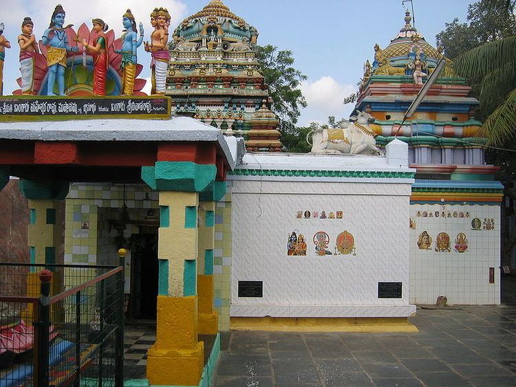
Prolaya Vema Reddi built number of Lord Shiva temples during his reign.Number of temples were constructed in Krishna valley during the reign of Vasireddy Venkatadri Nayudu. Tall towers (Gaali Gopuram) of these temples in many villages and towns of Guntur district stand testimony to his devotion and munificence. Some of the famous destinations are Nadivelamma Talli Temple in Rajavolu, and there will be annual festival on Full moon day in the month of Chaitra maas. Amaravathi temple, the abode of Lord Shiva, present in the form of a 15 ft (4.6 m) Shiva Linga. The Auspicious Hill of Mangalagiri town, is dedicated to Lord Narasimha with three temples of Panakala Narasimha Swamy on the hill, Lakshmi Narasimha Swamy at the foot of the temple, Gandala Narasimha Swamy at the top of the hill, are also famous. Other famous temples are Bhavanarayanaswami temple in Bapatla, Sri Laxmi Chennakesava Swamy Temple in Macherla, Kotappakonda, Pedakakani, Vykuntapuram in Tenali.
Economy
Paddy, tobacco, cotton,pulses and chillies are the main agricultural products cultivated in the district.
Transport
The total of core road network of the district is 1,274.632 km (792.020 mi). It includes, 458.230 km (284.731 mi) of existing and a proposed length of 816.403 km (507.289 mi).
Education and research
The primary and secondary school education is imparted by government, aided and private schools, under the School Education Department of the state. As per the school information report for the academic year 2015-16, there are a total of 4,739 schools. They include, 32 government, 2,839 mandal and zilla parishads, 2 residential, 1329 private, 14 model, 24 Kasturba Gandhi Balika Vidyalaya (KGBV), 296 municipal and 203 other types of schools. The total number of students enrolled in primary, upper primary and high schools of the district are 637,031. The district being home to the capital city, it is experiencing a growth in private international schools as well. The Central Board of Secondary Education, Secondary School Certificate or the Indian Certificate of Secondary Education are the different types of syllabus followed by different schools. The medium of instruction followed by different schools are English, Telugu and Urdu.
There are several junior colleges which are under government, residential, social welfare, disabled welfare, private aided and unaided for the purpose of imparting (10+2) education and the students sit for the certificate of Board of Intermediate Education. AC college is the oldest private aided college of the district, established in 1885. The higher education colleges have various fields of study like medical, nursing, degree, post graduate, polytechnic, law, teaching, pharmacy, engineering, veterinary etc. The Acharya Nagarjuna University is a state university which has fourteen autonomous colleges as per Universities Grant Commission. The Acharya N. G. Ranga Agricultural University at Lam is a public agricultural university, equipped with a Regional Agricultural Research Station.