
Founded 1816 Population 153,364 (2013) | Area 9,213 km² | |
 | ||
Rivers Penobscot River, East Branch Penobscot River Colleges and Universities University of Maine, Husson University, Eastern Maine Communi, Beal College, Bangor Theological Seminary Points of interest Acadia National Park, University of Maine Museum, Statues of Paul Bunyan, Maine Discovery Museum, Collins Center for the Arts | ||
Penobscot County is a county located in the U.S. state of Maine. As of the 2010 census, the population was 153,923. Its county seat is Bangor. The county was established on 15 February 1816 from a portion of Hancock County when the area was still part of Massachusetts.
Contents
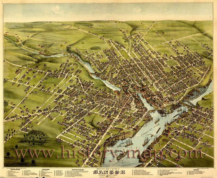
- Map of Penobscot County ME USA
- Geography
- Adjacent counties
- National protected area
- 2000 census
- 2010 census
- Politics
- Cities
- Plantations
- Indian reservation
- References
Map of Penobscot County, ME, USA
Penobscot County comprises the Bangor, ME Metropolitan Statistical Area.
Geography
According to the U.S. Census Bureau, the county has a total area of 3,557 square miles (9,210 km2), of which 3,397 square miles (8,800 km2) is land and 160 square miles (410 km2) (4.5%) is water.
Adjacent counties
National protected area
2000 census
As of the census of 2000, there were 144,919 people, 58,096 households, and 37,820 families residing in the county. The population density was 43 people per square mile (16/km²). There were 66,847 housing units at an average density of 20 per square mile (8/km²). The racial makeup of the county was 96.60% White, 0.49% Black or African American, 1.00% Native American, 0.70% Asian, 0.03% Pacific Islander, 0.23% from other races, and 0.96% from two or more races. 0.61% of the population were Hispanic or Latino of any race. 17.8% were of English, 17.3% United States or American, 14.0% French, 13.0% Irish and 6.7% French Canadian ancestry according to Census 2000. 95.8% spoke English and 2.3% French as their first language.
There were 58,096 households out of which 30.10% had children under the age of 18 living with them, 51.50% were married couples living together, 9.90% had a female householder with no husband present, and 34.90% were non-families. 26.70% of all households were made up of individuals and 10.00% had someone living alone who was 65 years of age or older. The average household size was 2.38 and the average family size was 2.88.
In the county, the population was spread out with 22.80% under the age of 18, 11.30% from 18 to 24, 29.00% from 25 to 44, 23.80% from 45 to 64, and 13.10% who were 65 years of age or older. The median age was 37 years. For every 100 females there were 95.30 males. For every 100 females age 18 and over, there were 92.30 males.
The median income for a household in the county was $34,274, and the median income for a family was $42,206. Males had a median income of $32,824 versus $23,346 for females. The per capita income for the county was $17,801. About 9.70% of families and 13.70% of the population were below the poverty line, including 15.00% of those under age 18 and 11.10% of those age 65 or over.
2010 census
As of the 2010 United States Census, there were 153,923 people, 62,966 households, and 38,917 families residing in the county. The population density was 45.3 inhabitants per square mile (17.5/km2). There were 73,860 housing units at an average density of 21.7 per square mile (8.4/km2). The racial makeup of the county was 95.4% white, 1.2% American Indian, 0.9% Asian, 0.8% black or African American, 0.2% from other races, and 1.5% from two or more races. Those of Hispanic or Latino origin made up 1.1% of the population. In terms of ancestry, 20.9% were English, 17.2% were Irish, 9.4% were American, 7.1% were German, 6.0% were French Canadian, and 5.9% were Scottish.
Of the 62,966 households, 27.5% had children under the age of 18 living with them, 47.1% were married couples living together, 10.3% had a female householder with no husband present, 38.2% were non-families, and 28.0% of all households were made up of individuals. The average household size was 2.33 and the average family size was 2.82. The median age was 39.9 years.
The median income for a household in the county was $42,658 and the median income for a family was $54,271. Males had a median income of $41,094 versus $31,910 for females. The per capita income for the county was $22,977. About 10.1% of families and 15.7% of the population were below the poverty line, including 20.4% of those under age 18 and 9.2% of those age 65 or over.
Politics
As the most populous county in Maine's 2nd congressional district, its support for Donald Trump in 2016 helped deliver him a split electoral vote from Maine. It was the first time since 1828 that Maine split its electoral votes.