
Existed: 1932 – present Length 4.6 km | Constructed 1932 | |
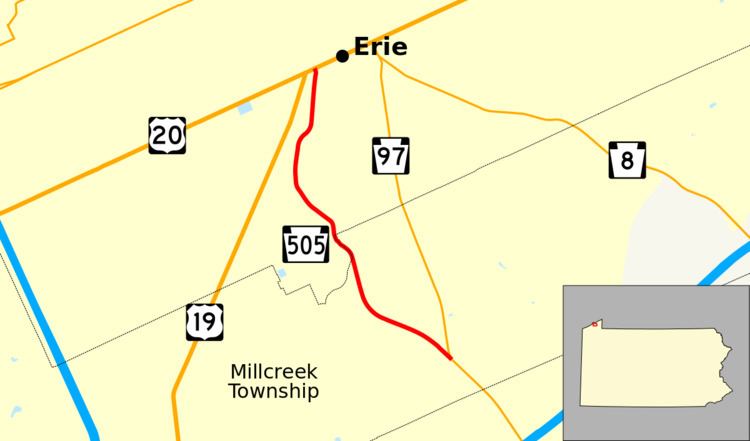 | ||
South end: PA 97 in Millcreek Township | ||
Pennsylvania Route 505 (PA 505) is a 2.86-mile-long (4.60 km) state highway located in northwest Pennsylvania. The route is a continuation of Pennsylvania Route 97 along the Perry Highway and ends at U.S. Route 20 in Erie as Glenwood Park Avenue.
Contents
Map of PA-505, Erie, PA, USA
Route description
PA 505 is a continuation of the Perry Highway from PA 97 in Millcreek Township. The road heads In the suburbs of Erie, PA 505 runs northward as Perry Highway (named for Oliver Hazard Perry, hero of the Battle of Lake Erie) and Glenwood Park Avenue through residential areas, between PA 97 and US 19. In Glenwood Park, the route passes by the Erie Zoo, running towards downtown Erie. North of the park, the highway runs through residential areas and ends in the downtown district of the city, at an intersection with US 20.
History
PA 505 was formed in the late 1920s along what is now the northernmost segment of Pennsylvania Route 97. By 1940, the route was moved to its current designation.
Major intersections
The entire route is in Erie County.