
Existed: April 1935 – present Counties: Bradford Constructed 1935 | North end: PA 706 in Camptown Length 6.457 km | |
 | ||
South end: US 6 in Standing Stone Township County | ||
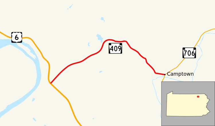
Pennsylvania Route 409 (PA 409) is a 4.01-mile-long (6.45 km) state highway located in Bradford County in Pennsylvania. The southern terminus is at U.S. Route 6 (US 6) in Standing Stone Township. The northern terminus is at PA 706 in Camptown. PA 409 runs through rural areas in eastern Bradford County as a two-lane undivided road. PA 409 was designated onto its present alignment in April 1935, running between US 6/US 309 in Limehill and US 106 (now PA 706) in Camptown.
Contents
Map of PA-409, Wyalusing, PA 18853, USA
Route description
PA 409 begins at an intersection with US 6 (the Grand Army of the Republic Highway) in the hamlet of Homets Ferry in Standing Stone Township. The route heads to the northeast, crossing an old alignment of US 6 in the middle of fields before heading into the woodlands nearby, making a gradual curve out along a stagecoach road. The scenery changes from fields back to woodlands until Comiskey Road, where PA 409 turns eastward through fields and passes a lone residence. After intersecting with a dirt road, the highway enters a large patch of forestry, paralleling nearby Billings Creek Road before entering the village of Camptown. In Camptown, PA 409 heads eastward through some residences before intersecting with PA 706 and State Route 1017 (Herrickville Road). This intersection is the northern terminus of PA 409.
History
When Pennsylvania legislated routes in 1911, the present-day PA 409 corridor was designated as part of Legislative Route 14, which ran from Towanda to Montrose. PA 409 was designated in April 1935 to run from US 6/US 309 in Limehill east to US 106 (now PA 706) in Camptown. Upon designation, the entire length of the route was paved. PA 409 has remained on the same alignment since.
Major intersections
The entire route is in Bradford County.