
Width 1.4 km (0.87 mi) Elevation 180 m | Length 1.7 km (1.06 mi) Highest elevation 180 m (590 ft) Population Uninhabited Peak Deacon Peak | |
 | ||
Similar Bridgeman Island, Deception Island, Brown Bluff, Mount Melbourne, Seal Nunataks | ||
Penguin Island (also known as Georges Island, Île Pingouin, Isla Pingüino, and Penguin Isle) is one of the smaller of the South Shetland Islands of Antarctica.
Contents
Map of Penguin Island, Antarctica
History
Penguin Island was sighted in January 1820 by a British expedition under Edward Bransfield, and so named by him because penguins occupied the shores of the island.
Description
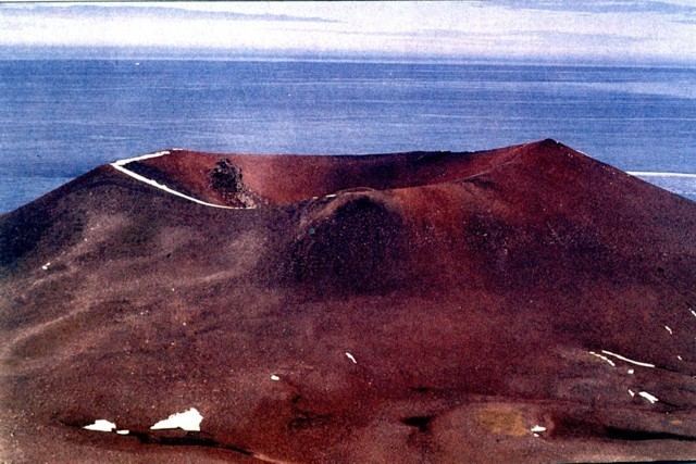
The island, which is ice-free and oval shaped, 1.4 km (0.87 mi) wide by 1.7 km (1.1 mi) long, lies close off the south coast of the much larger King George Island, and marks the eastern side of the entrance to King George Bay. It has a shoreline of low cliffs, with a beach on the north coast providing access. There is a small lake in the north-east. It is capped by Deacon Peak, a basaltic scoria cone. Deacon Peak was last thought to be active about 300 years ago. Petrel Crater, a maar crater, is located on the east side of the island, and is thought to have last erupted in or around 1905.
Important Bird Area
The island has been identified as an Important Bird Area (IBA) by BirdLife International because it supports a wide range of seabirds including a breeding colony of over 600 pairs of southern giant petrels. Other birds nesting at the site include Adélie and chinstrap penguins, Antarctic terns and kelp gulls. Weddell and southern elephant seals regularly haul out.