
Time zone EET (UTC+2) | ISO 3166 code GR-J | |
 | ||
Regional units ListArcadiaArgolisCorinthiaLaconiaMessinia | ||
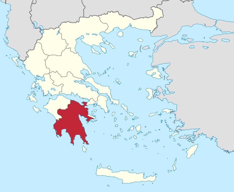
The Peloponnese region (Greek: Περιφέρεια Πελοποννήσου) is a region in southern Greece. It borders the West Greece region to the north and Attica to the north-east. The region has an area of about 15,490 square kilometres (5,980 square miles). It covers most of the Peloponnese peninsula, except for the northwestern subregions of Achaea and Elis which belong to West Greece and a small portion of the Argolid peninsula that is part of Attica.
Contents
Map of Peloponnese, Greece
Administration
The Peloponnese region was established in the 1987 administrative reform. With the 2010 Kallikratis plan, its powers and authority were redefined and extended. Along with the West Greece and the Ionian Islands regions, it is supervised by the Decentralized Administration of the Peloponnese, Western Greece and the Ionian Islands based at Patras. The region is based at Tripoli and is divided into five regional units (pre-Kallikratis prefectures), Arcadia, Argolis, Corinthia, Laconia and Messenia, which are further subdivided into 26 municipalities. The largest city of the region is Kalamata.
The region's governor is independent politician Petros Tatoulis, who was elected in the 2010 local elections and reelected in 2014.
Major communities
Unemployment Rate
The Greek financial crisis had severe consequences on Peloponnese's labor force. According to the statistics of the Labor Union of Korinthia, unemployment is recorded as follows: