
Width 200 km (120 mi) Highest point Unnamed peak | Length 360 km (224 mi) Highest elevation 1,910 m (6,270 ft) Elevation 1,910 m | |
 | ||
Adjacent bodies of water Victoria FjordArctic OceanIndependence Fjord | ||
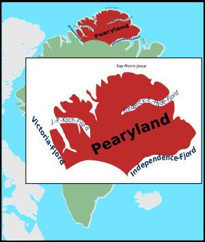
Peary Land is a peninsula in northern Greenland, extending into the Arctic Ocean. It reaches from Victoria Fjord in the west to Independence Fjord in the south and southeast, and to the Arctic Ocean in the north, with Cape Morris Jesup, the northernmost point of Greenland's mainland, and Cape Bridgman in the northeast.
Contents
- Nathan fake peary land though
- Geography
- Flora and fauna
- Human exploration and settlement
- Research
- References
Nathan fake peary land though
Geography
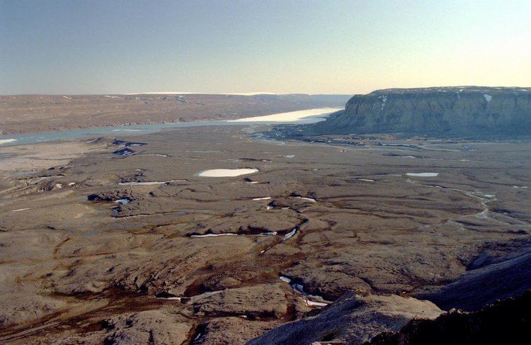
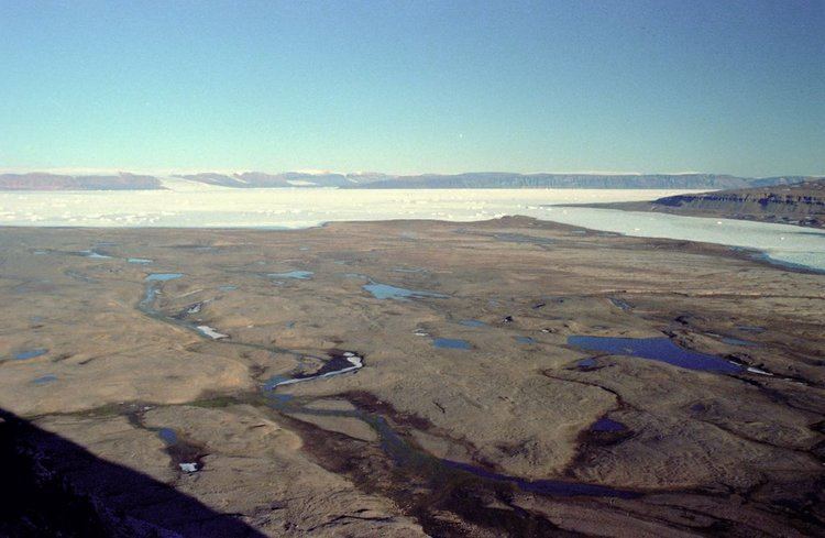
Peary Land is bounded by Lincoln Sea (west of Cape Morris Jesup) and Wandel Sea of the Arctic Ocean in the north. Oodaaq island, the northernmost point of land of the world, lies off the north coast. Frederick E. Hyde Fjord, which cuts into Peary Land from the east 150 km deep, divides it into Northern Peary Land and Southern Peary Land. The coastline is deeply indented by smaller fjords.
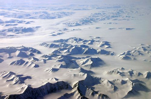
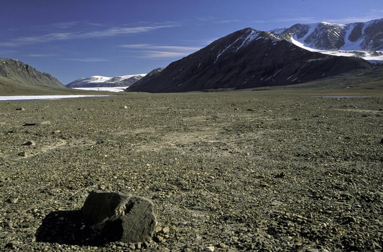
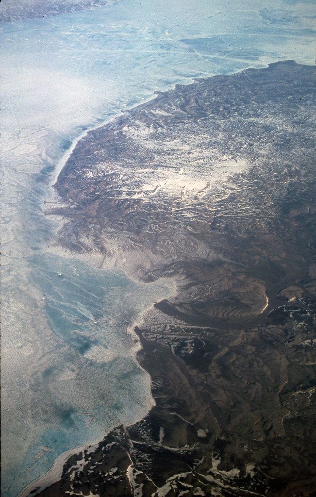
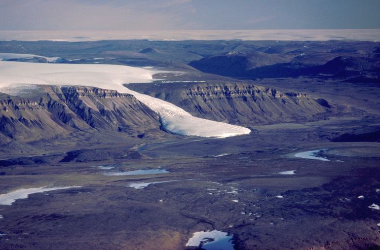
Peary Land is not part of any municipality, but is part of the Northeast Greenland National Park. The size of the region is about 375 km east-west and 200 km north-south, with an estimated area of 57 000 km2. It is only a bit more than 700 km south of the North Pole. It is free of Greenland's inland ice cap. Being mostly north of the 82°N parallel, it contains the most northerly ice-free region of the world, mostly in Southern Peary Land (such as Melville Land just north of the Independence Fjord). Precipitation levels are so low (only about 25 to 200 mm per year, all as snow) that it is called a polar desert. It was not covered by glaciers during the most recent ice age. However, in its western part, there is a local icecap, Hans Tausen Icecap, with ice at least 344 m thick.
Peary Land is mountainous, according to certain sources 1,737 m high Wistar Bjerg is the highest peak of Peary Land; 1,155 meters high Mara Mountain of the Roosevelt Mountain Range is another high summit. However, there are unnamed elevations reaching up to 1,950 m in the heavily glaciated Roosevelt Range and possibly comparable heights in the little-explored H.H. Benedict Range.
Originally, Peary Land was believed to be an island, separated from the main island by Peary Channel, an assumed connection between Victoria Fjord and Independence Fjord.
Flora and fauna
Caribou and musk oxen are supported by the sparse vegetation, which covers only about 5% of the surface, and which includes 33 species of flowering plants. Other fauna includes Arctic fox, polar wolf, polar bear, and Arctic hare.
One to two million years ago, when climates were warmer, trees such as larch, black spruce, birch, yew, and thuja grew in the northernmost Peary Land.
Human exploration and settlement
Peary Land was historically inhabited by three Inuit cultures, during which times the climate was milder than presently:
The area is named after Robert E. Peary, who first explored it during his expedition of 1891 to 1892.
Research
There are two Arctic research stations on Jørgen Brønlund Fjord, Brønlundhus (erected in 1948) and Kap Harald Moltke (erected in 1972). Both stations were built on initiative of Eigil Knuth, and have been the basis for many scientific expeditions. Kap Harald Moltke station was built later in connection with use of the natural runway east of Jørgen Brønlund Fjord mouth. The stations located 10 km from each other on either side of the fjord, with Brønlundhus on the western side, and communication between them in summer is by boat, depending on ice conditions. Since the death of Eigil Knuth, the stations are administered by Peary Land Foundation. Today, Brønlundhus can be characterised as a museum, with a collection of artefacts from polar explorations.